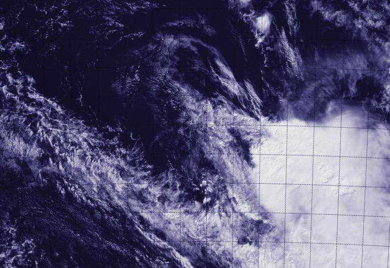
NASA-NOAA satellite sees the end of Tropical Cyclone Ikola

Strong vertical wind shear has taken a toll on Tropical Cyclone Ikola and that was pretty clear in a visible-light image from NASA-NOAA's Suomi NPP satellite today, April 8.
When Suomi NPP flew over Tropical Cyclone Ikola at 07:05 UTC (3:05 a.m. EDT), the Visible Infrared Imaging Radiometer Suite or VIIRS instrument aboard captured a visible image of the storm.
VIIRS is a scanning radiometer that collects visible and infrared imagery and "radiometric" measurements. Basically it means that VIIRS data is used to measure cloud and aerosol properties, ocean color, sea and land surface temperature, ice motion and temperature, fires, and Earth's albedo (reflected light).
The VIIRS image showed that the storm had basically unraveled and the bulk of clouds associated with it were pushed about 150 nautical miles (172.6 miles/277.8 km) southeast of the center. The thunderstorms were pushed by strong northwesterly vertical wind shear blowing between 40 and 50 knots. That wind shear also elongated the storm.
At 09:00 UTC (5 a.m. EDT), Tropical Cyclone Ikola's maximum sustained winds had dropped to 35 knots (40 mph/65 kph). It was centered near 21.2 south latitude and 98.6 east longitude, about 1,017 nautical miles (1,170 miles/1,883 km) west of Learmonth, Western Australia. Ikola was moving to the east at 12 knots (13.8 mph/22.2 kph), but fading fast.
The Joint Typhoon Warning Center forecast called for the strong northwesterly vertical wind shear to continue to deteriorate the system and lead to its dissipation later today.
Provided by NASA's Goddard Space Flight Center


