NASA-NOAA satellite sees semnants of ex-Tropical Cyclone Nathan

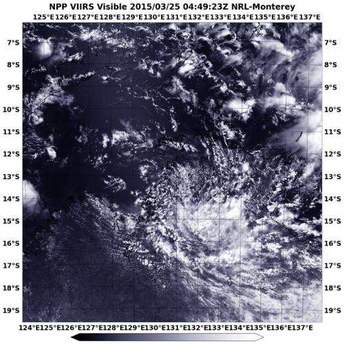
NASA-NOAA's Suomi NPP satellite captured an image of the remnants of Tropical Cyclone Nathan over the southern Top End of Australia's Northern Territory on March 25.
On March 25, the Australian Bureau of Meteorology (ABM) issued a Severe Weather Warning for heavy rainfall for people in the Daly, Arnhem, Carpentaria and Gregory forecast districts of Top End. The Top End contains the region's capital city of Darwin, and is home to Kakadu National Park, the country's largest national park. For updated watches and warnings, visit: http://www.bom.gov.au/cyclone/.
When Suomi NPP passed over Nathan on March 25 at 4:49 UTC (12:49 a.m. EDT) the Visible Infrared Imaging Radiometer Suite or VIIRS instrument aboard captured a visible image of the storm.
VIIRS is a scanning radiometer that collects visible and infrared imagery and "radiometric" measurements. Basically it means that VIIRS data is used to measure cloud and aerosol properties, ocean color, sea and land surface temperature, ice motion and temperature, fires, and Earth's albedo (reflected light). The Suomi NPP mission is a bridge between NOAA and NASA legacy Earth observing missions and NOAA's next-generation Joint Polar Satellite System, or JPSS.
The VIIRS image showed that the storm had basically unraveled and the bulk of clouds associated with the remnant low were southeast of the center. At 10:44 p.m. CST local time, the ABM noted that Ex-Tropical Cyclone Nathan was over the northern Daly District, just south-southwest of Darwin.
ABM noted two large rainfall totals that occurred in 24 hours as of 9 a.m. local time CST included 10.2 inches (261 mm) at Fanny Creek and 8.1 inches (208 mm) at Snowdrop Creek.
The remnant low is expected to move west into Timor Sea by early Thursday, March 26 (local time).
Provided by NASA's Goddard Space Flight Center


