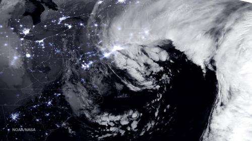
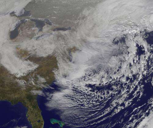
NASA and NOAA's nighttime and daytime views of the blizzard of 2015

NASA and NOAA have provided night-time and daytime views of the Blizzard of 2015 from the Suomi NPP and the GOES-East satellites.
A combination of the day-night band and high resolution infrared imagery from the NASA-NOAA's Suomi NPP satellite showed the historic blizzard near peak intensity as it moves over the New York through Boston Metropolitan areas at 06:45Z (1:45 a.m. EST) on January 27, 2015. The nighttime lights of the region were blurred by the high cloud tops associated with the most intense parts of the storm.
The center of the low pressure center was about 85 miles southeast of Nantucket, Massachusetts at 9:00 a.m. EST and had an estimated pressure of 975 millibars. The center of the storm was moving in a north-northeasterly direction.
At 10 a.m. EST, the National Weather Service noted "the powerful nor'easter that brought moderate to heavy snowfall and blizzard conditions to the Northeast on Monday will continue to affect the region on Tuesday, with heavy snow and blizzard conditions expected from eastern Long Island to Maine as the system slowly moves to the northeast. Snow and strong winds will being tapering off from south to north Tuesday night into Wednesday morning."
Later on January 27, 2015 at 17:35 UTC (12:35 p.m. EST) NOAA's Geostationary Operational Environmental or GOES-East satellite captured an image of the nor'easter over New England. The image was created by the NASA/NOAA GOES Project and showed the clouds associated with the nor'easter blanketing New England. An occluded front extended north and eastward out of the low pressure area's center out into the Atlantic Ocean.

GOES satellites provide the kind of continuous monitoring necessary for intensive data analysis. Geostationary describes an orbit in which a satellite is always in the same position with respect to the rotating Earth. This allows GOES to hover continuously over one position on Earth's surface, appearing stationary. As a result, GOES provide a constant vigil for the atmospheric "triggers" for severe weather conditions such as tornadoes, flash floods, hail storms and hurricanes.
Provided by NASA's Goddard Space Flight Center


