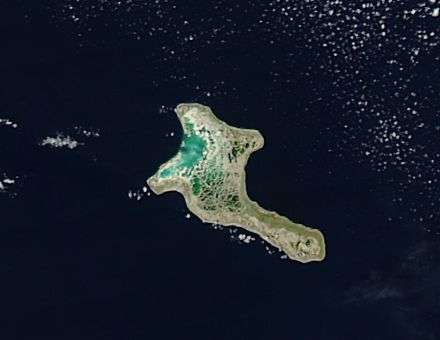
NASA satellite spots Christmas

If you're looking for Christmas NASA's Aqua satellite spotted it in the Southern Indian Ocean. It's a coral atoll (a ring-shaped reef, island, or chain of islands made up of coral) in the northern Line Islands and is a Territory of Australia.
When Aqua flew over Christmas Island on Nov. 11, 2014, the Moderate Resolution Imaging Spectroradiometer took a visible picture of the small atoll.
The island is only 135 square kilometers (52.2 square miles) in area, which is (41.7 km squared) 16.1 square miles smaller than the city of Washington, D.C. The island has a tropical equatorial climate with a wet season that runs from December to April. During the island's dry season where heat and humidity are moderated by trade winds.
Although an Australian Territory, Christmas Island is located 2,600 km (1,616 miles) north-west of Perth, Western Australia. The island is famous for land dwelling red crab which scramble to the sea each November to release eggs.
Provided by NASA


