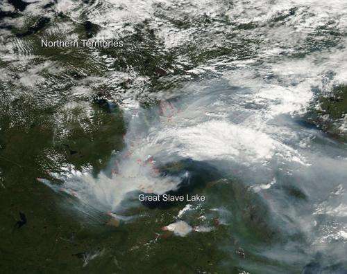
Image: Fires not slowing around Yellowknife

Fires and the resultant smoke that comes from them are both just as widespread and heavy as they were in the month of July. Hundreds of fires dot the landscape and the Northwest Territories Live Fire map shows the extent of the wildfires and hot spots that have been reported. Fire danger around this area of the Northwest Territories remains in either the high or extreme range. On the live fire map, notated detections of new fires number in the dozens. These fires are ones having been detected within the last 24 hours. Residents of Yellowknife were witness to red lightning recently due to the amount of smoke in the atmosphere coloring the lightning strikes.
Environment Canada reported that the Air Quality Health Index reached 12 on Sunday, August 03, 204. It explained that "the higher the number, the greater the health risk associated with the air quality. When the amount of air pollution is very high, the number will be reported as 10+."
Since early June and the beginning of the Northwest Territories fire season, there have been 333 fires that have burned over 2.8 million hectares of land (6,918,950 acres). This information is from the August 3, 2014 NWT Fire Situation Report.
Provided by NASA's Goddard Space Flight Center


