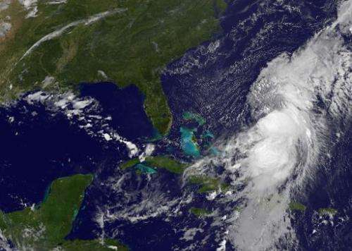
Hurricane churns towards Bermuda, to impact US

A strengthening Hurricane Cristobal had Bermuda in its sights Tuesday, US meteorologists said, warning of heavy rain, high winds and life-threatening rip currents in Florida and beyond.
The storm, which has dumped rain on the Bahamas and the Turks and Caicos Islands, killing one person, was packing maximum sustained winds of 75 miles (120 kilometers) per hour, the Miami-based National Hurricane Center (NHC) said in its latest forecast, at 1800 GMT.
A tropical storm watch was already in effect for Bermuda, forecasters said, meaning inclement conditions were possible in the next 24-36 hours.
"The center of Cristobal is expected to pass northwest of Bermuda on Wednesday," the NHC said.
It added: "Swells generated by Cristobal are affecting portions of the United States coast from central Florida northward to North Carolina and will spread northwards later this week."
Cristobal, a category one hurricane, is the third hurricane of the Atlantic storm season.
It comes hot on the heels of Hurricane Marie, which briefly reached the highest possible category five destructive power but was weakening in the Pacific off Mexico.
Now a category two hurricane on the Saffir-Simpson scale, Marie's crashing waves over the weekend caused a fishing vessel to capsize, with three of its occupants still missing and presumed dead.
© 2014 AFP


