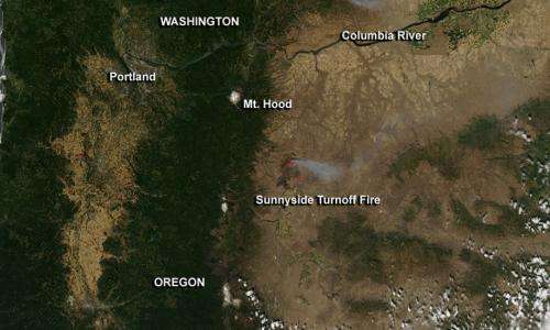
Oregon's sunnyside turnoff fire

NASA's Aqua satellite captured an image of smoke from northern Oregon's Sunnyside Turnoff Fire on July 25 as the satellite passed overhead in space.
The Moderate Resolution Imaging Spectroradiometer (MODIS) instrument that flies aboard Aqua captured an image of the smoke and heat from the Sunnyside Turnoff Fire on July 25 at 21:10 UTC (5:10 p.m. EDT/2:10 p.m. PDT). MODIS has the ability to detect hot spots or fires and they appear red in the image.
The Incident Information System called InciWeb noted the Sunnyside Turnoff Fire had covered 48,916 acres by July 26, 2013. On that day, the fire was 40 percent contained. The fire is approximately 3-5 miles north of Warm Springs, Oregon. The Warm Springs area has been evacuated, and the Charley Canyon area is closed to the public. The fire was caused by man on Saturday, July 20.
Provided by NASA's Goddard Space Flight Center


