A "DisasterCam" for the ISS

Of all the hundreds of spacecraft and satellites in Earth orbit, few can match the International Space Station for its view of the big blue marble below. Scientists would like to put that spectacular view to good use – by having the ISS photograph disasters, both natural and manmade, in progress on the Earth below.
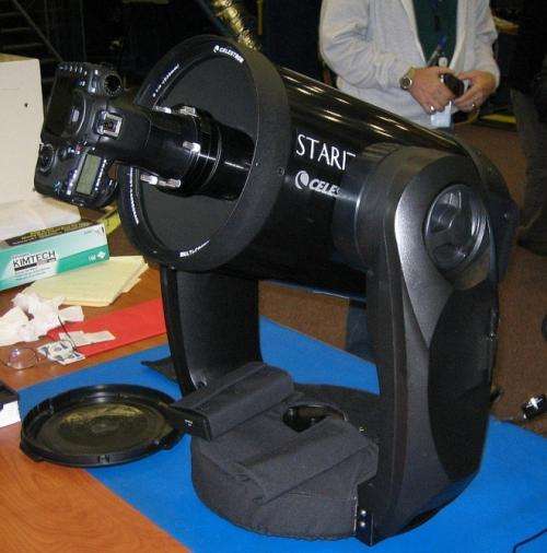
Thanks to a collaboration between the NASA/USAID program known as SERVIR within NASA’s Applied Sciences Program, and NASA’s ISS program, the station will be outfitted with a new instrument – part of a system called ISERV – and equipped with a prototype automated camera which could image areas threatened by floods, landslides, forest fires, or other disasters.
At this point, ISERV is specifically intended to help scientists gain the experience and expertise to deploy an operational system in the future, and to inform its design. Ideally, a future operational system, and perhaps ISERV Pathfinder itself, will be able to monitor Earthly disasters.
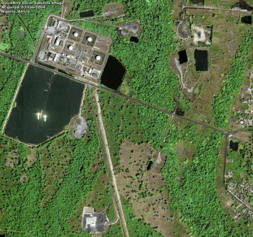
"Let’s assume an earthen dam gives way in Bhutan," says Burgess Howell, a science lead for SERVIR. "With an instrument like Pathfinder, we could show disaster officials where the bridge is out, for example, or the hospital is gone, the road washed out, or the power substation inundated. We could also estimate the number and location of structures destroyed and the amount of agricultural land affected. All of this information is critical to focus and speed rescue efforts."
ISERV's Pathfinder camera will be installed this summer in the ISS Destiny module, with a view through its 20-inch Earth-facing window. Pathfinder's special software knows where the space station is at each moment as well as its attitude, direction, and path. With this information it calculates the next chance to view a particular area. If there's a good viewing opportunity, the SERVIR team will send instructions to the camera. Pathfinder will take a series of high-resolution photographs of the area at 7 frames per second for 6 to 8 seconds, totaling 40-60 images per pass.
"The camera's nominal resolution is 2.8 meters. That's about the size of a cow, although we may be able to sense the presence of smaller targets, down to the size of a person."

An operational system with Pathfinder's optical characteristics could, in many cases, acquire near-real-time images of areas on the ground and transmit them within hours of the event.
"In ideal conditions, the party requesting the data could receive them within 3 hours," says Howell. "But in some cases, because of the station's varying orbit, it might be 3 days before a viewing opportunity arises. Even then the data could be used to analyze environmental changes the disaster causes, and this is vital information."
SERVIR is a Spanish acronym meaning "to serve." Also known as the Regional Visualization and Monitoring System, the program serves by providing satellite data and tools to environmental decision makers in developing countries. ISERV, short for ISS SERVIR Environmental Research and Visualization System, is the program's first exclusive space asset.
Howell expects to acquire valuable information about how a more capable future system might operate –a system that would be mounted outside the space station and equipped with more and better instruments.
"By going outdoors and removing the physical and optical constraints of looking through a window, the sensors would be able to 'see' all the way to edge of the Earth, and with much greater spectral range. The glass in Destiny’s window can diminish the incoming energy and is opaque to some of the wavelengths of energy of primary interest to Earth science."
Once its primary mission is satisfied, the current system could be used to acquire image data for general use. At first, these data would be used only by SERVIR and its hubs in East Africa and the Hindu Kush-Himalaya region. After proving itself, ISERV could then be made available for the entire NASA science community and possibly other entities.
The SERVIR team is excited about ISERV's potential to help people on Earth. Howell is eager to learn, through ISERV, more about how to use this kind of system so they can do it even better in the future.
ISERV is targeted to launch to the space station in July and will be one of the least expensive long-term operating payloads ever to ride on the space station.
But the return, in the long run, could be priceless.
Provided by NASA


