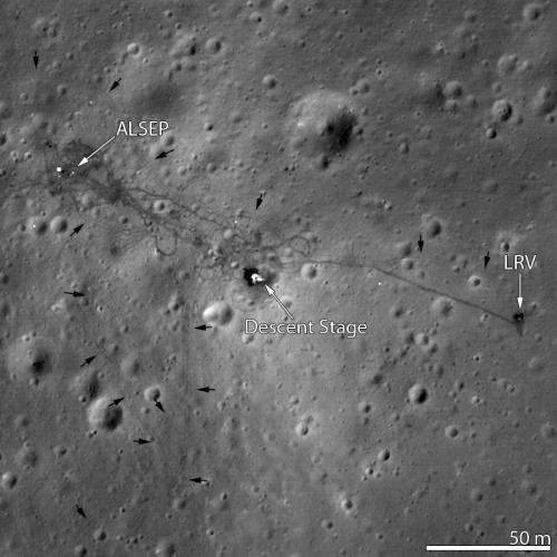
Space Image: Apollo 15 - Follow the tracks

(PhysOrg.com) -- The Apollo 15 Lunar Module (LM) Falcon set down on the Hadley plains (26.132°N, 3.634°E) a mere 2 kilometers from Hadley Rille.
The goals: sample the basalts that compose the mare deposit, explore a lunar rille for the first time, and search for ancient crustal rocks. Additionally, Dave Scott and Jim Irwin deployed the third Apollo Lunar Surface Experiments Package (ALSEP) and unveiled the first Lunar Roving Vehicle (LRV).
The ALSEP consisted of several experiments that were powered by a Radioisotope Thermoelectric Generator (RTG) and sent back valuable scientific data to the Earth for over six years after the astronauts left.
This new LROC NAC image taken from low altitude shows the hardware and tracks in even more detail.
Provided by JPL/NASA


