GPS Becomes Ubiquitous
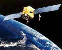
GPS – (Global Positioning System) is everywhere these days. Once the jealously guarded domain of the military, it now helps even granny find her way to market.
GPS is essentially an improvement over previous radio based navigation systems. British WWII bombers first used a system called GEE. This consisted of radio “beams” which guided them to bombing points. In the 1960s the Navy used TRANSIT and in the 1970s, boaters used a system called LORAN. Basically, a radio receiver calculated the distance to two or more radio transmitters and computed its relative position using 2D coordinates. All that changed in 1993 when the last of the NAVSTAR GPS - Navigation Signal Timing and Ranging Global Positioning System – satellites were put into orbit.
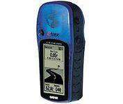
GPS’s big advantage over older systems is its ability to give 3D coordinates – latitude, longitude and elevation, great for flyers, hikers and climbers. Another is its accuracy – to within a centimeter in some models.
The basis for this technology is the atomic clock. With the ability to synchronize their time to billionth of a second on each satellite, the systems know their exact position in time and space. They also keep an internal log of the exact positions of other satellites to aid receivers in location fixing.
The first handheld units were the size of a brick and used mostly by boaters, but current models can be as small as cell phones and used by just about anyone. Prices have come down greatly and accuracy has improved dramatically too. Pioneering models were over $3,000 and were only accurate to 100 meters. New handheld units are around a $100 and have 10 meter accuracy.
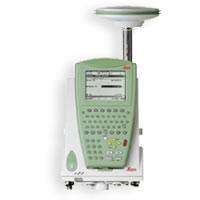
Surveyor and scientific models can still cost $3,000 or more, but these models incorporate special software to offer millimeter precision.
Using a GPS today involves little more than turning it on, waiting a moment and noting your position. And because latitude, longitude and elevation coordinates won’t mean much to the average user, new units have a built-in map display showing their position on a small LCD screen.
Some useful tips for getting the most accrate results from a GPS system are available here.
Users of Palm PCs may consider getting a TomTom kit. This consists of a bluetooth receiver and software that displays maps on the Palm screen. Map expansions and updates are available to keep the system up to date.
The military used to “dither” or degrade signals to reduce accuracy. GPS makers, however, have long been able to circumvent this obstacle. Dithering, also known as Selective Availability (SA) has been turned off for some time now, making the signals very accurate.
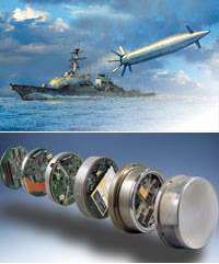
So accurate in fact, that a rogue state could launch a missile using a commercial GPS as guidance. Theoretically, it would be capable of hitting a target with centimeter precision. Perhaps that’s why GPS satellites serve another purpose - detection of ballistic missile launches.
The military also makes extensive use of GPS for positioning troops, vehicles, ships and planes. It is this huge investment in satellites that affords free access to GPS to commercials users.
GPS uses are endless: marine navigation, automated mapping, personal navigation, the Geocaching game (see link), surveying, navigation for the blind and even as a time keeper; GPS satellites can give atomic-precision time to any receiver.
GPS promises to be even more pervasive in the future, especially in the military. Draper Labs is developing a low-cost, low-profile navigation module for the Navy to guide shells fired from standard 5 inch gun turrets found on destroyers, cruisers and frigates.
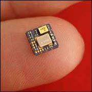
Soon, with the huge reduction in size, we may find GPS in our wristwatches and cell phones – both for timekeeping accuracy and positioning purposes. Given that that would also broadcast the users location. it would, of course, also lead to concerns of personal privacy and many users would demand a facility to switch the GPS locating off (see link).
GPS could become a feature in almost every aspect of life in the future. Autonomous vehicles, airplanes and ships could soon be navigating without a human pilot. Individuals, including blind people could have GPSs implanted and never lose their sense of direction.
As prices drop, expect tiny GPS chips to be integrated into just about every electronic accessory from Palm PCs to cell phones.
By Philip Dunn, Copyright 2006 PhysOrg.com


