Gone in a puff of smoke: 52,000 square kilometers of 'long unburnt' Australian habitat has vanished in 40 years
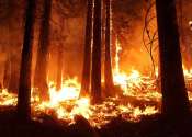
Landscapes that have escaped fire for decades or centuries tend to harbor vital structures for wildlife, such as tree hollows and large logs. But these "long unburnt" habitats can be eliminated by a single blaze.