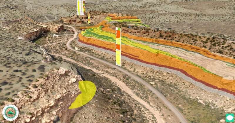
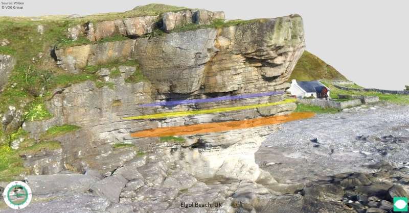
Unique 3-D virtual environments with the new LIME v2.0 software and V3Geo cloud storage

No wonder there is currently a lot of interest around on social media and the internet in ways to experience natural environments virtually.
The coronavirus restrictions affect so many countries, sectors, companies and people's lives—including students, researchers and professionals working in geoscience.
The LIME v2.0 software release coincides with the recent launch of a new website and cloud storage solution:V3Geo.
Around 120 virtual 3-D geoscience models are hosted on V3Geo, letting users stream 3-D models in their LIME projects, all accessible from a laptop or a mobile device. And the number is growing all the time.
"These days the usage of 3-D virtual models from e.g. outcrops is extremely beneficial, as practically no one is allowed to travel to the field for courses or excursions," says research professor Simon Buckley at NORCE—Norwegian Research Centre in Bergen, Norway.
Educate staff, increase competence
Different industries and companies can benefit from having virtual training and courses in geoscience by using LIME, as they always are looking to educate their staff and increase their competence.
"Furthermore, the software will be beneficial for several purposes under normal circumstances, after the corona pandemic is over," senior researcher Nicole Naumann adds.
Some outcrops can be very difficult to access and study.
"We hope with this new LIME release to build a sustainable platform for the future to share knowledge, build stronger networks, support fieldwork and teaching—not only in times where physical contact is restricted," Naumann says.
Users can now utilize 3-D models in a much broader sense, for example adding supplementary data to the 3-D models to build, and possibly extend, their own virtual field trips and teaching material.

Virtual field trips
The first version of LIME was released in 2016 by VOG, The Virtual Outcrop Geology Group. VOG is a collaboration between NORCE and The University of Aberdeen, Scotland.
V3Geo is also part of this long-term initiative.
A lot has happened since the first release. Many new features have been added, including ways to make virtual field trips, and this will increase in the weeks and months to come, Buckley adds.
Linking LIME and V3Geo.com is a unique possibility in the world and the field of geoscience.
"We hope that LIME v2.0 can also contribute to a technology transfer to other geoscience disciplines and beyond," Nicole Naumann says.
The researchers see many similar needs in other geoscience disciplines where 3-D mapping and virtual environments can be game-changing.
Examples are in glaciology, natural hazards, infrastructure projects for tunnels and roads, mining, volcanology and many more.
In the near future, it will also be possible for users to upload their own models to V3Geo and share them with the greater geoscience community.
A global user base
The software has already received much positive attention from research groups and companies around the world, so it has a global user base.
As spring arrives, Buckley believes that many can benefit from using the improved version, since the first edition back in 2016 was limited to visualization of your own data, without any options for field trips.
"Spring is the time of year that universities and industry professionals would normally go out and study outcrops, do field mapping and arrange courses, to strengthen knowledge and competence. Since travel restrictions in the corona pandemic put an end to this, we decided to push forward our LIME v2.0 release, to offer a virtual field experience," Buckley says.
He predicts the LIME software will be highly beneficial after the corona pandemic because some outcrops can be very difficult to access and study.
Field trips also require a lot of preparation, which can be costly in time and resources.
"Our software makes it easier to prepare for field excursions, as well as study outcrops and other natural phenomena from the office," Buckley says.
Finally, not everyone is in the lucky position to go out to the field, for whatever reason, so tools like LIME and V3Geo help to increase accessibility to geoscience data and field areas.
Both Buckley and Naumann hope LIME v2.0 and V3Geo will be used in a broader geoscience context, such as within geomorphology, volcanology, glaciology, and e.g in infrastructure projects for tunnels, roads, mining and many more.
Provided by NORCE


