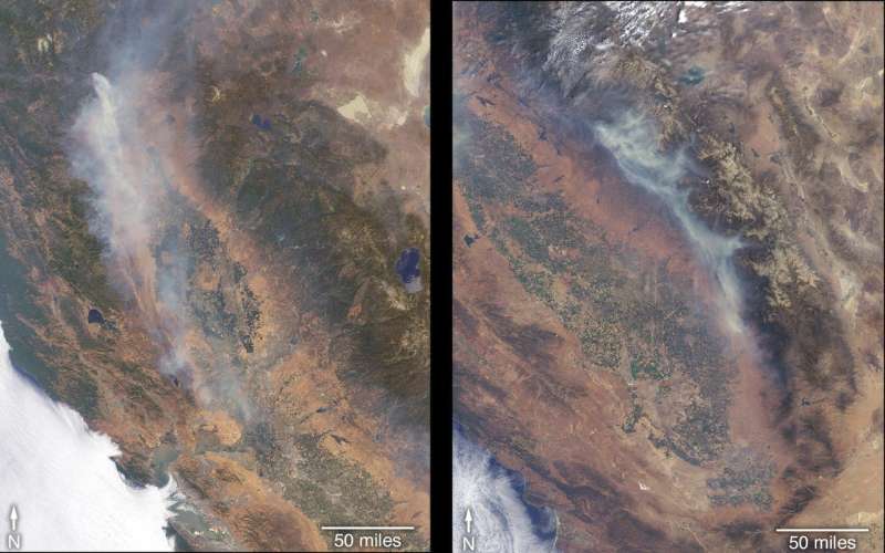
Image: Satellite views fires raging in California

More than a dozen wildfires are burning in the state of California, with several of them threatening life and property. The Ferguson Fire (right) ignited July 13 in the Sierra National Forest west of Yosemite National Park. Much of the forest in this area suffered extreme stress due to the extended drought of 2012 through 2017, and bark beetle damage, leaving many dead trees through which the fire has burned rapidly. Many surrounding towns have been under evacuation orders, and many popular areas of the national park were closed on July 25.
On July 23, another fire ignited northwest of Whiskeytown Lake, a reservoir in northern California. Dubbed the Carr Fire (left), it remained relatively small through July 25, but advanced rapidly toward the city of Redding the following day, prompting mass evacuations.
The Multi-angle Imaging SpectroRadiometer (MISR) instrument on NASA's Terra satellite passed over California on July 27 and July 29, observing the Carr Fire on July 27 and the Ferguson Fire on July 29. The MISR instrument has nine cameras that view Earth at different angles.
Provided by NASA


