Point patterns help to predict landslides

Examining the detail of a natural disaster in Italy in 2009 has helped KAUST researchers develop a statistical model that could help predict landslides in specific areas under given storm scenarios.
Existing landslide susceptibility models use a presence-absence structure to predict whether a landslide is likely within a given area. These binary models, however, are unable to predict vital information, such as how many landslides might occur on any specific slope.
Luigi Lombardo, and his supervisor Raphaël Huser, at KAUST, with Thomas Opitz at INRA in France, developed a statistical model that exploits the rigorous probabilistic framework of point processes. This describes the behavior of random point patterns, such as landslide-triggering locations.
Their statistical methodology enables the model to predict not only where, but also how many, landslides may occur in a given area depending on climatic circumstances.
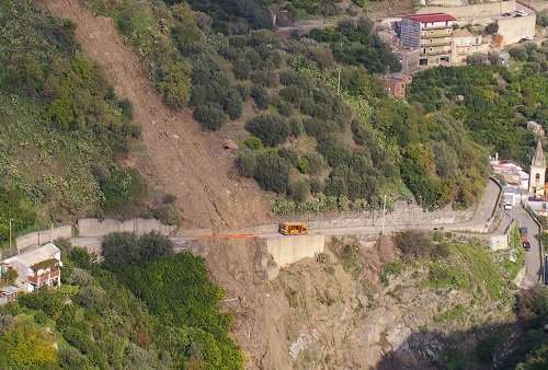
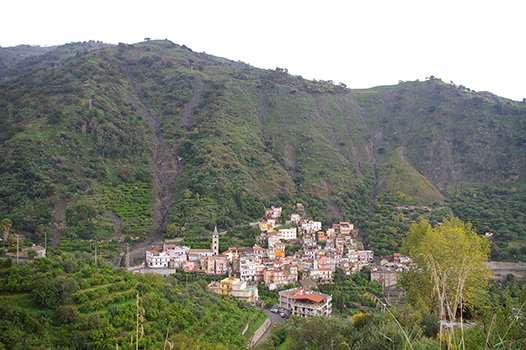
The team used their model to examine data from a 2009 disaster in Messina, Italy, which followed an intense storm. The model generated highly accurate maps of the disaster zone.
"Following two periods of wet weather, the storm dumped 250 millimeters of rain on a small area in less than eight hours," says Lombardo. "The soils on the steep slopes were already saturated, and the deluge resulted in around 5,000 landslides of varying sizes across about 100 square kilometers."

The team accessed high-resolution satellite images showing the landscape before and after the storm. However, they did not have complete data regarding the landslide trigger—the rainfall event—because there was only one weather station in the storm zone.
"Scientists simply do not have the instrumentation in place to measure every natural disaster in depth," says Lombardo. "However, we realized that the data could 'talk' to us and help us reconstruct the storm. We knew where the worst, repeated landslides had occurred, and logic suggests that these points were the areas hit by the most rainfall."
"We included a latent spatial effect in our statistical model to flexibly capture and reconstruct the evolution of the storm," says Huser. "This latent spatial effect, combined with other variables, such as slope steepness, soil type and vegetation cover, yielded an unprecedented prediction accuracy."
"The benefit of this approach is that we can easily simulate various latent spatial effects, each one with a different pattern, and provide a comprehensive set of likely future landslide scenarios as a storm evolves," says Lombardo. "Authorities could then take better preventative actions and evacuate people to safer ground. Similar models could be built for other landslide-prone areas in the world."
Provided by KAUST


