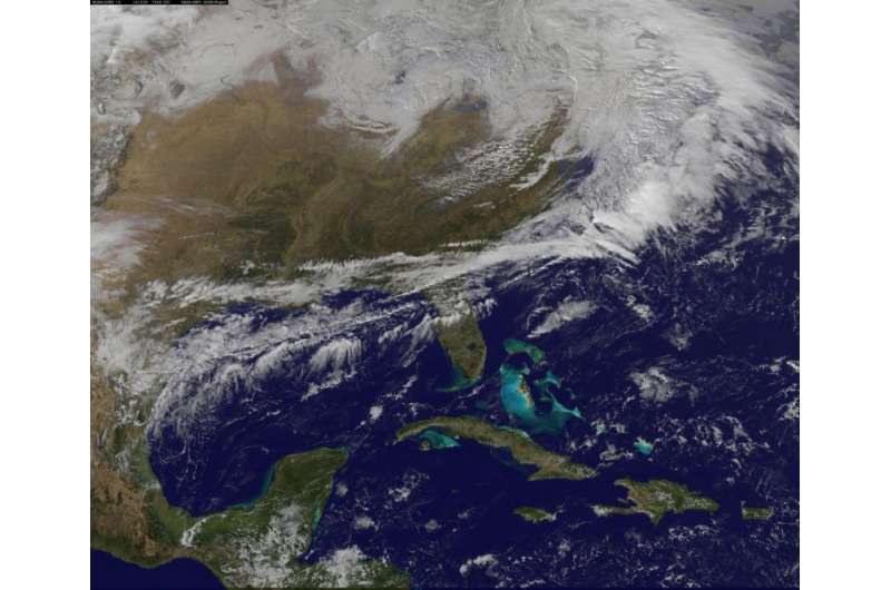
Image: Satellite view of big snowstorm for the Northeastern U.S.

The National Weather Service has forecast a significant winter storm to impact the Interior Northeastern U.S. today, Thursday, Dec. 29 and Friday, Dec. 30. Imagery and animations from NOAA's GOES-East satellite show the clouds associated with this powerful storm were already over New England.
NOAA's GOES-East satellite provides infrared and visible data of the eastern half of the U.S. At the NASA-NOAA GOES Project, NASA Goddard Space Flight Center in Greenbelt, Maryland, that data is made into images and animations. The NASA-NOAA GOES Project created a visible image of the monster storm that was already affecting the northeastern U.S. at 1:30 p.m. EST (1830 UTC). At that time, the low pressure center was north of the Great Lakes and was moving east.
The project also made an animation of NOAA's GOES-East satellite's infrared and visible images from Dec. 27 to Dec. 29 that showed the development and easterly movement of the snowmaker.
At 1:30 p.m. EST on Dec. 29, light snow was reported in Concord, New Hampshire, where a Winter Storm Warning is in effect until December 30, 05:00 a.m. EST.
The National Weather Service (NWS) in Gray, Maine stated "A low pressure will intensify as it reaches the New England coastline late today. It is expected to track northeastward along the coast of Maine and New Hampshire tonight...bringing a period of very heavy snowfall to interior areas. Snow will transition to rain during the late afternoon and evening near the coast. This will limit accumulations closer to the coastline. Just inland of the transition zone snowfall accumulations will be quite heavy."
In addition, heavy snowfall is also expected from the Berkshires in eastern New York and western Massachusetts through southern Vermont where a winter storm warning remains in effect until 7 a.m. EST on Dec. 30. The NWS forecasts heavy snow and accumulations of 6 to 12 inches, except 5 to 9 inches in southern Berkshire County where rain may briefly mix with snow.
The NWS Storm Prediction Center in College Park, Maryland noted "Storm total accumulations of a foot or more are possible from the Adirondacks to western Maine. Gusty winds will also accompany the storm making travel across much of the region hazardous and difficult."
The NWS forecast brings the center of the low over Maine on Friday, December 30 and out over the Atlantic Ocean by Saturday, December 31.
More information: For updated forecasts, visit the NWS website: www.weather.gov
Provided by NASA


