Light reflection pinpoints Pilbara weed invasion

Remote weed detection is set for major advancement after Curtin University researchers successfully used satellite spectral imagery to pinpoint clusters of one of Australia's most invasive weed species in the Pilbara.
The research could improve weed management plans for farmers and mining companies working on large areas of land.
The scientists used WorldView-two satellite imagery covering a 430 hectare site, about the size of a small suburb in the Perth metropolitan area, at Mardie Pastoral Station.
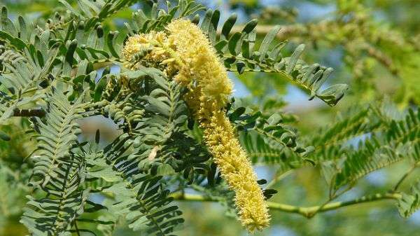
They used the imagery to identify populations of the invasive shrub mesquite (a group of several closely related Prosopis species native to the Americas).
The satellite's eight-band resolution sensors capture visible to near infrared light, which can be used to detect things like vegetation health, leaf mass and moisture content of plants.
Curtin Department of Spatial Sciences researcher Dr Todd Robinson, who led the study, says they successfully differentiated the heavily defoliated mesquite from native vegetation using the satellite's sensors.
"Each plant has a different spectral signature which means they absorb and reflect electromagnetic radiation differently, but sometimes these differences to can be too subtle to identify with standard remote sensing tools," he says.
"However with mesquite, because it is defoliated, it's not reflecting the infrared as much as the coexisting healthy vegetation and this was pronounced in four of the satellite's eight bands, so that was how we could differentiate it.
"It worked better than we expected."
Satellite method similar in cost to airborne surveys
Dr Robinson says using new generation satellites to detect light reflection from plants is comparable in cost to standard airborne surveys, but has added versatility.
"Surveys have been mainly airborne until now and the downside to that is generally poorer coverage or additional pre-processing to stitch images together," he says.
"The satellite can provide much greater coverage and, as it can be tasked to capture imagery very rapidly and you don't need a pilot."
Dr Robinson says the technology can be used as a monitoring tool by repeatedly acquiring the same imagery to see how much it changes and how much it is invading the area over time.
He says the next step is expanding the research to a wider area and testing its effectiveness on other plants.
"I think it's transferrable to many other different species," he says.
"We would like to look at the entire station and also see if it's transferrable to another weeds of national significance in the Pilbara, such as Parkinsonia (Parkinsonia aculeate)."
Provided by Science Network WA
This article first appeared on ScienceNetwork Western Australia a science news website based at Scitech.


