Aerial surveys generate first human activity maps for the Kimberley coast
Maps of human activity along the western Kimberley coast generated from aerial surveys have provided key insights for conservation and sustainable development of the region.
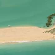
Professor Lynnath Beckley from Murdoch University has led a team who spent two years using low altitude aerial surveys to monitor human activity along the Kimberley coast and adjacent waters.
"People always talk about the remoteness and the emptiness of the Kimberley but this is the first time anyone has actually quantified human presence along the whole coast," said Professor Lynnath Beckley.
"We were interested in finding out where people were spending time along the coast, and also what they were doing."
The survey area ran along Eighty Mile Beach, Roebuck Bay, the Dampier Peninsula, King Sound, Buccaneer Archipelago and Camden Sound.
"This sort of information is vital for environmental managers and the Department of Parks and Wildlife to appropriately plan for biodiversity conservation and tourism, particularly as human activities in the area grow," Professor Beckley said.
"The coast from Port Hedland to Wyndham has Traditional Owners, towns and communities, commercial endeavours, tourism and recreation activities and several marine parks.
"There are about 40,000 residents in the study area with more than 16,000 people living on the Dampier Peninsula."
Results of the surveys showed that human use of the region is very seasonal and concentrated in particular areas of the coast with good road access.
As expected, the number of people along the shore and number of boats operating in coastal waters were much higher during the dry season from May to October. Nevertheless, local residents were observed to get out and about during the wet season to participate in various recreational activities.
"On Eighty Mile Beach people were mainly concentrated around the caravan park with anglers and their associated four-wheel drive vehicles clumped into about 30 kilometres of coastline," she said.
"Camping during the dry season was largely confined to the larger caravan parks at Eighty Mile Beach and Port Smith, but also seen at Barn Hill Station and Cape Keraudren.
"This study has provided a spatially explicit benchmark of human recreational activities at the inception of the newly created Eighty Mile Beach Marine Park," Professor Beckley said.
The research team also monitored boating in the central Kimberley region, through both aerial surveys and a collation of data about voyages of cruise vessels.
"Cruise vessels operate mainly from April to September between Broome and Wyndham with most of the vessels offering boutique expeditions with less than 20 passengers.
Montgomery Reef was the most popular destination in their itineraries with 275 visits by cruise vessels in 2013.
"Along with Montgomery Reef, the most popular sights for cruise vessels included Horizontal Falls, Raft Point, Prince Regent River and Talbot Bay. Passengers often go ashore in small boats to swim, fish and undertake scenic walks to view waterfalls, rock art and historical sites," Professor Beckley said.
Provided by Murdoch University


