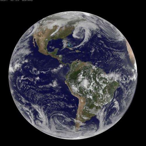
NASA image: Three low pressure areas around the US

There are three low pressure systems around the U.S. and they resemble dragons on satellite imagery. NOAA's GOES-13 and GOES-15 satellite image from March 31, 2014 shows the low pressure systems in the eastern Pacific Ocean, over the nation's Heartland, and in the eastern Atlantic Ocean. All three lows have the signature comma shape that make them appear to be curled up dragons.
According to the National Weather Service, the low pressure area approaching the northwestern U.S. is expected to bring rainfall to the coast and areas of snow that stretch from western Washington state south toward the four corners region. The low in the middle of the country is located over Nebraska and dropping snow to the north and west of it. That same low is bringing rain from southern Minnesota south to eastern Texas. Meanwhile, the third low pressure system is bringing rain and snow to parts of New England.
NOAA's GOES-East satellite sits in a fixed orbit in space capturing visible and infrared imagery of all weather over the eastern U.S. and Atlantic Ocean.
The data to create this image was taken on March 31, 2014 at 17:45 UTC/1:45 p.m. EDT by NOAA's GOES-East or GOES-13 satellite and made into an image by NASA/NOAA's GOES Project at NASA's Goddard Space Flight Center in Greenbelt, Md.
Provided by NASA Image of the Day


