WHOI conducts latest search for Air France Flight 447

The Woods Hole Oceanographic Institution (WHOI) is again teaming with French authorities to renew the international search for the deep-sea wreck site of Air France Flight 447 and to retrieve the flight recorders from the Airbus A 330.
WHOI will lead the search from late March to July 2011 under the authorization of the Bureau d’Enquêtes et d’Analyses, BEA, the French Bureau of investigation and analysis for civil aviation safety.
Flight 447, a scheduled commercial flight from Rio de Jeneiro to Paris, crashed into the Atlantic Ocean on June 1, 2009, carrying 216 passengers and 12 crew members. Searchers have been unable to locate the aircraft in three attempts since then.
The search is being targeted in an area of about 3,900 square miles (10,000 square kilometers), several hundred miles off Brazil’s northeastern coast. The team plans to begin searching areas it did not search last year and intends to completely survey the entire search zone until the wreckage is located.
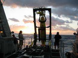
The recovery mission, aboard the vessel Alucia, left the harbor of Suape, Brazil on March 22 with a crew of 34. It will include the use of three autonomous underwater vehicles (AUVs), the REMUS 6000s, designed and operated by WHOI. Two of the vehicles are owned by the Waitt Institute for Discovery; the third is owned by IFM-GEOMAR of Germany.
These autonomous undersea vehicles are designed to operate in depths up to 6,000 meters (19,685 feet or 3.73 miles). As each vehicle covers an area in a “mowing” type pattern, it employs side-scan sonar to survey up to 600 meters to its left and right. Capable of staying underwater for up to 20 hours at a time, REMUS then returns to the ship, where scientists immediately download its data. If the data contains evidence of any debris or other items of interest undersea, a REMUS 6000 will be dispatched to gather more detailed, up-close images using high-resolution cameras located on the bottom of the vehicle.
WHOI Senior Engineer Mike Purcell is the chief of sea search operations for the mission. Addressing members of the media earlier in the week, Purcell said his team is confident in the ability of the REMUS vehicles to find the wreckage.
While the search is underway, the BEA will issue a weekly progress report on its website, providing families, the media and the general public with an updated operation status produced by WHOI.
"There is no better team or technology available to handle this mission," said David Gallo, director of special projects at WHOI. “The plane was lost over the Mid-Ocean Ridge, a feature that we have been exploring for more than 30 years. The terrain will be extremely rugged and the search will be difficult, but this is something that we have been doing as a part of our mission to explore and understand the global oceans.”
Provided by Woods Hole Oceanographic Institute


