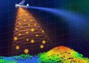
Camera chip provides superfine 3-D resolution

Imagine you need to have an almost exact copy of an object. Now imagine that you can just pull your smartphone out of your pocket, take a snapshot with its integrated 3-D imager, send it to your 3-D printer, and within minutes ...

LIDAR system offers peerless precision in remote measurements

By combining the best of two different distance measurement approaches with a super-accurate technology called an optical frequency comb, researchers at the National Institute of Standards and Technology have built a laser ...

page 1 from 13

LIDAR

LIDAR (Light Detection And Ranging, also LADAR) is an optical remote sensing technology that can measure the distance to, or other properties of a target by illuminating the target with light, often using pulses from a laser. LIDAR technology has application in geomatics, archaeology, geography, geology, geomorphology, seismology, forestry, remote sensing and atmospheric physics, as well as in airborne laser swath mapping (ALSM), laser altimetry and LIDAR contour mapping.

The acronym LADAR (Laser Detection and Ranging) is often used in military contexts. The term "laser radar" is sometimes used, even though LIDAR does not employ microwaves or radio waves and therefore is not radar in the strict sense of the word.

This text uses material from Wikipedia, licensed under CC BY-SA