Cyclone bears down on flood-hit Kenya, Tanzania
Beaches were deserted and many shops closed on Saturday as heavy rains and winds from a tropical cyclone buffeted coastal areas of Tanzania and Kenya.

Beaches were deserted and many shops closed on Saturday as heavy rains and winds from a tropical cyclone buffeted coastal areas of Tanzania and Kenya.
Environment
May 5, 2024
0
7

Kenya and Tanzania were on alert on Saturday for a cyclone heading towards their Indian Ocean coastlines, threatening to pile on more misery after deadly floods that have ravaged the region.
Environment
May 3, 2024
0
8

The death toll from flood-related incidents in Kenya has crossed 200 since March, the interior ministry said Friday, as a cyclone barrelled towards the Tanzanian coast.
Environment
May 3, 2024
0
7
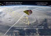
New research finds that modern weather models can accurately predict satellite movements due to the energy emitted and reflected by the Earth. In addition to weather prediction, weather models can also help understand and ...
Earth Sciences
Apr 19, 2024
0
144

Coastal communities need to prepare for simultaneous extreme weather events as heat waves increasingly overlap with surges in sea levels due to climate change, a study published on Thursday warned.
Environment
Apr 14, 2024
0
18

Tropical cyclones, also known as hurricanes and typhoons, are meteorological phenomena that occur over tropical and subtropical oceans experiencing low atmospheric pressure, where water vapor from the warm oceans condenses ...

The sun's differential rotation pattern has puzzled scientists for decades: While the poles rotate with a period of approximately 34 days, mid-latitudes rotate faster and the equatorial region requires only approximately ...
Astronomy
Mar 27, 2024
0
236

To assess a community's risk of extreme weather, policymakers rely first on global climate models that can be run decades, and even centuries, forward in time, but only at a coarse resolution. These models might be used to ...
Earth Sciences
Mar 26, 2024
0
18

Global warming, the long-term warming of Earth's overall temperature, has greatly accelerated in the last 100 years due to human factors such as the burning of fossil fuels. Along with this trend, certain atmospheric phenomena ...
Earth Sciences
Mar 15, 2024
0
70

The largest and nearest of the giant outer planets, Jupiter's colorful clouds present an ever-changing kaleidoscope of shapes and colors. This is a planet where there is always stormy weather: cyclones, anticyclones, wind ...
Planetary Sciences
Mar 14, 2024
0
17
In meteorology, a cyclone refers to an area of closed, circular fluid motion rotating in the same direction as the Earth. This is usually characterized by inward spiraling winds that rotate counter clockwise in the Northern Hemisphere and clockwise in the Southern Hemisphere of the Earth.
Large-scale cyclonic circulations are almost always centred on areas of low atmospheric pressure. The largest low-pressure systems are cold-core polar cyclones and extratropical cyclones which lie on the synoptic scale. Warm-core cyclones such as tropical cyclones, mesocyclones, and polar lows lie within the smaller mesoscale. Subtropical cyclones are of intermediate size. Cyclones have also been seen on other planets outside of the Earth, such as Mars and Neptune.
Cyclogenesis describes the process of cyclone formation and intensification . Extratropical cyclones form as waves in large regions of enhanced midlatitude temperature contrasts called baroclinic zones. These zones contract to form weather fronts as the cyclonic circulation closes and intensifies. Later in their life cycle, cyclones occlude as cold core systems. A cyclone's track is guided over the course of its 2 to 6 day life cycle by the steering flow of the polar or subtropical jetstream.
Weather fronts separate two masses of air of different densities and are associated with the most prominent meteorological phenomena. Air masses separated by a front may differ in temperature or humidity. Strong cold fronts typically feature narrow bands of thunderstorms and severe weather, and may on occasion be preceded by squall lines or dry lines. They form west of the circulation center and generally move from west to east. Warm fronts form east of the cyclone center and are usually preceded by stratiform precipitation and fog. They move poleward ahead of the cyclone path. Occluded fronts form late in the cyclone life cycle near the enter of the cyclone and often wrap around the storm center.
Tropical cyclogenesis describes the process of development of tropical cyclones. Tropical cyclones form due to latent heat driven by significant thunderstorm activity, and are warm core. Cyclones can transition between extratropical, subtropical, and tropical phases under the right conditions. Mesocyclones form as warm core cyclones over land, and can lead to tornado formation. Waterspouts can also form from mesocyclones, but more often develop from environments of high instability and low vertical wind shear.
This text uses material from Wikipedia, licensed under CC BY-SA