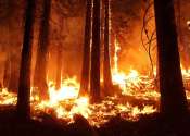
Is forest harvesting increasing in Europe? Nature response throws doubt on controversial study claims
Is forest harvesting increasing in Europe? Yes, but not as much as reported last July in a controversial study published in Nature.

Is forest harvesting increasing in Europe? Yes, but not as much as reported last July in a controversial study published in Nature.
Environment
Apr 28, 2021
1
12

Satellite images show how quickly clouds respond to aerosols emitted by ships, helping inform climate modeling.
Earth Sciences
Apr 26, 2021
0
175

UC Riverside engineers are developing methods to estimate the impact of California's destructive wildfires on air quality in neighborhoods affected by the smoke from these fires. Their research, funded by NASA and the results ...
Environment
Apr 21, 2021
0
12

Researchers at Duke University have developed a method that uses machine learning, satellite imagery and weather data to autonomously find hotspots of heavy air pollution, city block by city block.
Earth Sciences
Apr 15, 2021
0
131

Cows don't seem to have a whole lot going on most of the time. They're raised to spend their days grazing in the field, raised for the purpose of providing milk or meat, or producing more cows. So when students in UC Santa ...
Plants & Animals
Apr 13, 2021
0
9

Emily Ury remembers the first time she saw them. She was heading east from Columbia, North Carolina, on the flat, low-lying stretch of U.S. Highway 64 toward the Outer Banks. Sticking out of the marsh on one side of the road ...
Plants & Animals
Apr 6, 2021
2
55

Come summer, Utahns will flock to the state's lakes and reservoirs to boat, swim and picnic along the shore. And every week, if not every day, scientists like Kate Fickas of Utah State University in Logan will use satellite ...
Environment
Mar 23, 2021
0
8

Using NASA satellite images and machine learning, researchers with The University of Texas at Austin have mapped changes in the landscape of northwestern Belize over a span of four decades, finding significant losses of forest ...
Earth Sciences
Mar 15, 2021
0
24

The amount of snow falling on Greenland's glaciers may have been less than the water lost through icebergs calving and melting since at least the mid-1980s, a study of almost 40 years of satellite images has revealed.
Earth Sciences
Mar 5, 2021
87
994

Researchers at Stevens Institute of Technology have developed a new machine learning-powered platform, known as OC-SMART, that can process ocean color in satellite images 10 times faster than the world's leading platform. ...
Environment
Feb 24, 2021
0
19