Warming temperatures are driving Arctic greening

As Arctic summers warm, Earth's northern landscapes are changing. Using satellite images to track global tundra ecosystems over decades, a new study found the region has become greener, as warmer air and soil temperatures ...

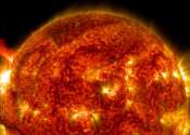
New analysis method predicts disruptive solar flares

Solar flares—violent explosions on the surface of the sun—can send blasts of radiation hurtling toward Earth. While the planet's magnetic field protects humans on the surface, powerful solar flares can disable satellites, ...

New imaging system creates pictures by measuring time

A radical new method of imaging that harnesses artificial intelligence to turn time into visions of 3-D space could help cars, mobile devices and health monitors develop 360-degree awareness.

Satellite images reveal global poverty

How far have nations come in achieving the U.N.'s sustainable development goals? It can be difficult to make a global assessment of poverty and poor economic conditions, but with an eye in the sky, researchers are able to ...

page 6 from 38