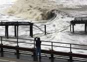
From New York to Jakarta, land in many coastal cities is sinking faster than sea levels are rising
Sea level rise has already put coastal cities on notice thanks to increasing storm surges and even sunny day flooding at high tide. These challenges will continue to grow because global projections point to a mean sea level ...