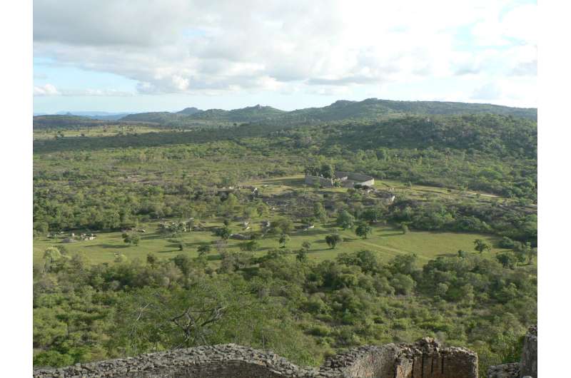
The ruins of the ancient city of Great Zimbabwe. The vegetation around the ruins hides a lot of depressions, so-called Dhaka pits, which until now have been thought to have originated from the excavation of clay. With remote sensing methods and excavations, the researchers have found that the pits must also have been used to store and manage water for the city. Credit: Federica Sulas, Cambridge University
In the mountains of southeastern Zimbabwe lie the ruins of the first major city in the southern Africa. The place is known as Great Zimbabwe. The name Zimbabwe itself means "the big stone house" in the Shona language, and in fact the country got its name from the ancient city. The city with large stone houses and enclosures was the 11th century the capital of the Shona kingdom in parts of present-day Zimbabwe and Mozambique.
The city flourished and many people lived there until it was abandoned in the 17th century. But how did the people living there fulfill their needs? Particularly challenging was water—Great Zimbabwe is located in a climate-sensitive area so ensuring a stable supply of water for so many people and so many cattle must have been a problem.
This mystery has been investigated by a group of researchers from South Africa, England, Zimbabwe and Denmark in the article "Climate-smart harvesting and storing of water: The legacy of dhaka pits at Great Zimbabwe," now published in the journal Anthropocene.
With remote sensing methods and excavation, they investigated a number of large depressions in the landscape, which are locally called "dhaka" pits. The depressions have not been investigated before, as it has been thought that they were made only to collect clay used for building in the city. However, the new studies show that this may not be the whole truth.
The investigations show that the pits must also have been used to store and manage water for the city. There are clear signs that the depressions have been excavated where they can collect surface water, and at the same time seep and store ground water for use during the dry periods of the year. The researchers found more "dhaka" pits than were known before, and they have been found where small streams will naturally run through the landscape when it rains or where ground water seeps out.
-
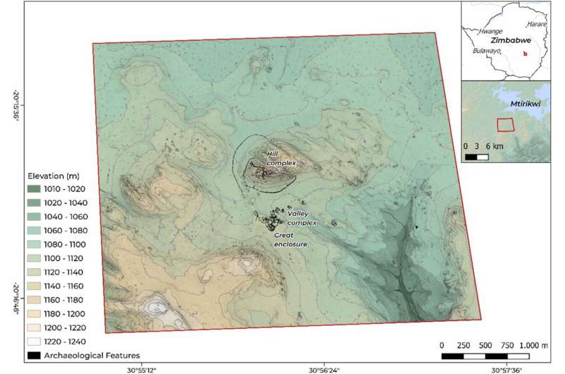
Map of Great Zimbabwe showing the main archaeological complexes. Credit: Anthropocene (2022). DOI: 10.1016/j.ancene.2022.100357
-
Airborne laser scanning (ALS) mapping workflow. Credit: Anthropocene (2022). DOI: 10.1016/j.ancene.2022.100357
This, combined with the location and construction of the depressions, has convinced the researchers that the "dhaka" pits functioned as a clever system to ensure a stable water supply, by storing more surface and ground water that could be used outside the rainy season as well.
The people of Great Zimbabwe thus devised climate-smart methods for storing and managing water in an area that is characterized by having three different climates, with a very warm and dry season, a warm and wet season and finally a warm and dry winter. Such a water supply may have been essential in order to create an urban society that required a safe supply of water for its inhabitants, for livestock and for agriculture.
It is impressively conceived and shows that, much earlier than previously thought, management of the natural hydrological system was under control in the city. Perhaps they even managed it so well that other places in the world can now learn something from how they did it hundreds of years ago in Great Zimbabwe.
More information: Innocent Pikirayi et al, Climate-smart harvesting and storing of water: The legacy of dhaka pits at Great Zimbabwe, Anthropocene (2022). DOI: 10.1016/j.ancene.2022.100357
Provided by Aarhus University


