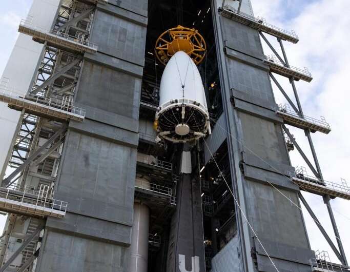
The National Oceanic and Atmospheric Administration’s (NOAA) Geostationary Operational Environmental Satellite-T (GOES-T), enclosed in its payload fairing, is moved into the Vertical Integration Facility at Space Launch Complex 41 at Cape Canaveral Space Force Station in Florida on Feb. 17, 2022. Credit: NASA/Kim Shiflett
The National Oceanic and Atmospheric Administration's (NOAA) Geostationary Operational Environmental Satellite-T (GOES-T) satellite now officially has its ride.
GOES-T was transported from Astrotech's Space Operations facility in Titusville, Florida, to United Launch Alliance's (ULA) nearby Vertical Integration Facility at Cape Canaveral Space Force Station's Space Launch Complex 41. It was then mated to the top of the Atlas V 541 rocket, which will carry it into space. Liftoff is targeted for March 1, 2022, at 4:38 p.m.
The launch is managed by NASA's Launch Services Program based at the agency's Kennedy Space Center, America's multi-user spaceport.
After securing GOES-T atop the Atlas V, technicians conducted final validation of the communication paths through the rocket. The spacecraft and launch vehicle were then tested by successfully powering up both into launch mode to ensure they are compatible as a system.
GOES-T had been located inside the Astrotech facility since its arrival to Florida on Nov. 10, 2021. Numerous activities were conducted there, including lifting and mating the spacecraft to the payload adapter, and encapsulation, where the two halves of the ULA payload fairings were brought together and installed around the satellite to protect it during launch. The fully assembled launch vehicle will roll to the launch pad on Feb. 28.
The third satellite in NOAA's GOES-R series, GOES-T will be delivered into a geosynchronous transfer orbit, separated from the launch vehicle, and then moved up to a higher geostationary orbit and renamed GOES-18. After being checked out, calibrated, and deemed ready for operations, GOES-18 will replace GOES-17 in the GOES-West position, keeping an eye on the U.S. West Coast, Alaska, Hawaii and the Pacific Ocean.
The GOES satellite network helps meteorologists observe and predict local weather events that affect public safety, including thunderstorms, tornadoes, fog, hurricanes, flash floods, and other severe weather.
Provided by NASA


