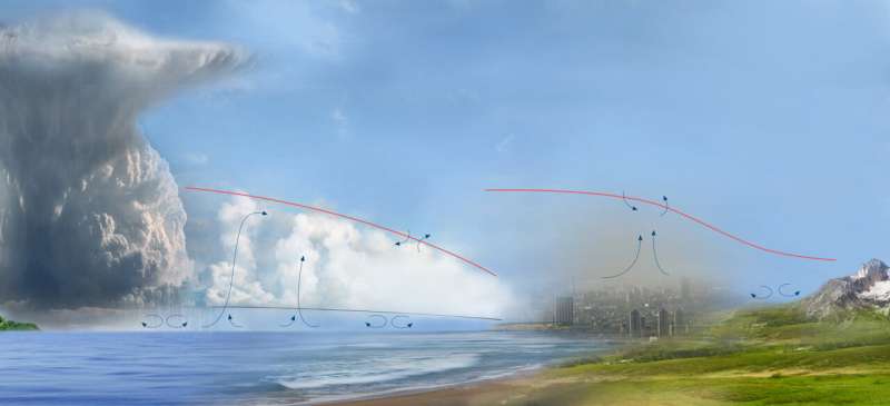
The planetary boundary layer is where people live, and it includes weather and airborne particulates that affect us all. Studying it from space is a NASA priority for the coming decades, but this goal comes with significant challenges. Credit: Joseph Santanello/NASA PBL Study Team
The part of the atmosphere closest to the planet is the hardest to measure from space due to the volume of gases above it. Studying Earth's planetary boundary layer, or PBL, will enable scientists to better understand the interaction between Earth's surface and weather and how that evolves in a global, changing climate.
"The planetary boundary layer is where we live and where we experience weather," NASA Researcher Dr. Antonia Gambacorta said. "It's been studied in great detail with lots of ground-based measurements, but there are large gaps, like over oceans and polar regions where we don't have as many ground-based instruments. Having the capability from space to probe and measure the boundary layer is important to study the connections between this layer and the rest of our atmosphere on a global basis."
Accurate, real-time measurement of PBL temperature and water vapor from space enables more accurate prediction of rapidly changing extreme events, providing significant benefits to the economy.
"From space, you're trying to measure a signal that gets weakened as it gets absorbed and re-emitted along the way," said Gambacorta, an Earth science researcher at NASA's Goddard Space Flight Center in Greenbelt, Maryland. "You also have interfering noise from the surface and clouds."
The "signal" scientists use to study Earth's surface and atmosphere on a global scale go beyond the visible light our eyes can see to include infrared and microwave frequencies of the electromagnetic spectrum.
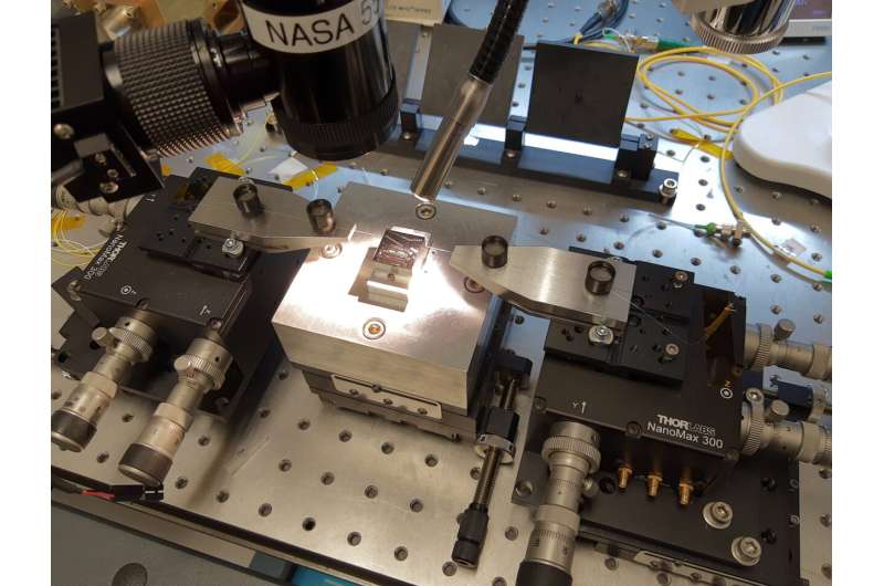
A photonics integrated chip including several circuits rests on a stage in a characterization setup. Credit: Fabrizio Gambini
Infrared wavelengths of lights are absorbed by liquid droplets and ice particles that make up clouds. However, those same clouds are partially transparent to microwave light. In addition, different parts of the microwave spectrum provide information about different properties of the PBL that can affect weather: water vapor, clouds, and temperature.
Existing spaceborne microwave sensors and even planned instruments, however, detect only a couple dozen channels within the microwave spectrum. This limits the vertical resolution and accuracy of the data, especially from the boundary layer.
Hyperspectral microwave measurements break the microwave region of the spectrum down into hundreds or even thousands of individual frequencies. Capturing and interpreting these frequencies would provide as clear a view as possible of this crucial layer from a global perspective, Gambacorta said.
Hyperspectral microwave measurements have been long advocated by meteorological and space agencies worldwide to improve data collection from orbit in order to improve climate and weather prediction, said Dr. Joseph Santanello, a NASA researcher who was among the leading contributors to the NASA Planetary Boundary Layer Incubation Study Team report and co-investigator of this project. The report lists hyperspectral microwave sensors as an essential component of the future global PBL observing system.
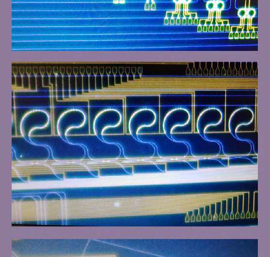
Images of photonic circuits: the blue lines are photonic integrated waveguides, while the yellow lines are metal lines for integrated heaters. Credit: Fabrizio Gambini
Two-front approach
In order to provide meaningful information and visualizations for scientists and meteorologists as well as big-data users such as NOAA and the EPA, Gambacorta's team has to solve two major technical hurdles.
They must first dramatically reduce the size, weight, and power requirements of existing radio frequency signal processors by converting microwave frequencies to optical signals. These signals will be processed by multiple photonic integrated circuits (PICs), said Dr. Mark Stephen, an engineer with Goddard's Research Engineering Partnership.
"We have computer models and a preliminary breadboard system assembled to show that optical processing on a PIC should work," Stephen said. "If we can convert radio frequency into an optical signal and back into radio, we can show that we can reduce the size weight, power, and cost of the instrument without degrading the information content in the signal."
These savings will allow them to integrate many of these PICs, each processing a different set of bandwidths. The result will be the first of its kind hyperspectral microwave photonic instrument (HyMPI) capable of measuring Earth's full microwave radiation spectrum. This instrument matured through three years of funding from Goddard's Internal Research and Development, or IRAD program. Now the Earth Science Technology Office is providing further development resources.
The second hurdle is processing the massive amounts of data these sensors will capture into something scientists and meteorologists can understand. Gambacorta is working to advance the data processing software effort with help from another IRAD grant.
"We have already concluded how hyperspectral microwave sounding performs under simulated clear sky conditions," Gambacorta said. "This year, we're modeling how clouds affect hyperspectral microwave measurements. This remote sounding capability will help achieve a global perspective on the makeup and behavior of the boundary layer."
Provided by NASA's Goddard Space Flight Center


