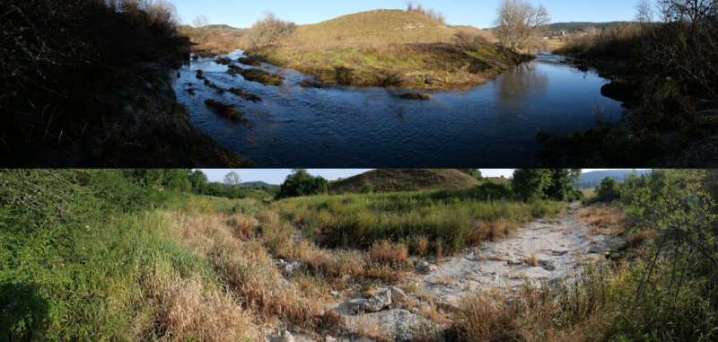
An open-source smartphone application to monitor drying events in river networks

Citizens can play a major role in helping scientists to understand drying river networks, by reporting drying events in rivers and streams. To do so, DRYvER has created the DRYRivERS app, which citizens can use to map drying events. The collected data will improve scientific predictions of the future impacts of climate change in these ecosystems. Moreover, DRYRivERS will raise awareness of the importance of drying events in river networks.
Every smartphone user who enjoys nature and the outdoors can contribute by documenting wet and dry conditions in streams and rivers using the DRYRivERS app, which is available on Google Play and App Store, links available directly from the project website. The app is open-source and easy to use. All you need to do is add (1) the location of the river site; (2) the in-channel conditions i.e., whether the channel contains flowing water, disconnected standing pools or is dry; and (3) a photo of the site. You can use your phone's GPS to determine your location, or you can find existing spots on the map. The app caches all necessary data when it is running with Wi-Fi or mobile internet, so do not worry if you have no network coverage while finding a dry stream. After you record a new spot, you can simply save it and upload the information later once a network connection is again available.
All the observations made by citizens with the DRYRivERS app will be openly accessible and visualized on DRYvER website.
Using DRYRivERS will generate the first network of real-time observations of drying events across rivers and streams. Ultimately, a European atlas of drying river networks will be created, including all observations from DRYRivERS, as well as other sources. In turn, this information will inform the development of models that anticipate the effects of climate change on streams and rivers.
More information: Project website: www.dryver.eu/citizen-science
Provided by INRAE - National Research Institute for Agriculture, Food and Environment


