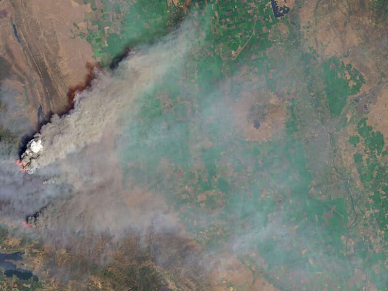
Satellite sensor EPIC detects aerosols in Earth's atmosphere

Aerosols are small, solid particles that drift aloft in Earth's atmosphere. These minuscule motes may be any of a number of diverse substances, such as dust, pollution, and wildfire smoke. By absorbing or scattering sunlight, aerosols influence Earth's climate. They also affect air quality and human health.
Accurate observations of aerosols are necessary to study their impact. As demonstrated by Ahn et al., the Earth Polychromatic Imaging Camera (EPIC) sensor on board the Deep Space Climate Observatory (DSCOVR) satellite provides new opportunities for monitoring these particles.
Launched in 2015, DSCOVR's orbit keeps it suspended between Earth and the Sun, so EPIC can capture images of Earth in continuous daylight—both in the visible-light range and at ultraviolet (UV) and near-infrared wavelengths. The EPIC near-UV aerosol algorithm (EPICAERUV) can then glean more specific information about aerosol properties from the images.
Like other satellite-borne aerosol sensors, EPIC enables observation of aerosols in geographic locations that are difficult to access with ground- or aircraft-based sensors. However, unlike other satellite sensors that can take measurements only once per day, EPIC's unique orbit allows it to collect aerosol data for the entire sunlit side of Earth up to 20 times per day.
To demonstrate EPIC's capabilities, the researchers used EPICAERUV to evaluate various properties of the aerosols it observed, including characteristics known as optical depth, single-scattering albedo, above-cloud aerosol optical depth, and ultraviolet aerosol index. These properties are key for monitoring aerosols and their impact. The analysis showed that EPIC's observations of these properties compared favorably with those from ground- and aircraft-based sensors.
The research team also used EPIC to evaluate the characteristics of smoke plumes produced by recent wildfires in North America, including extensive fires in British Columbia in 2017, California's 2018 Mendocino Complex Fire, and numerous North American fires in 2020. EPIC contributed to the observational proof of smoke self-lofting via the tropopause by solar absorption–driven diabatic heating in 2017. EPIC observations successfully captured these huge aerosol plumes, and the derived plume characteristics aligned accurately with ground-based measurements.
This research suggests that despite coarse spatial resolution and potentially large errors under certain viewing conditions, EPIC can serve as a useful tool for aerosol monitoring. Future efforts will aim to improve the EPICAERUV algorithm to boost accuracy.
More information: Changwoo Ahn et al, Evaluation of Aerosol Properties Observed by DSCOVR/EPIC Instrument From the Earth‐Sun Lagrange 1 Orbit, Journal of Geophysical Research: Atmospheres (2021). DOI: 10.1029/2020JD033651
Journal information: Journal of Geophysical Research - Atmospheres
Provided by American Geophysical Union
This story is republished courtesy of Eos, hosted by the American Geophysical Union. Read the original story here.


