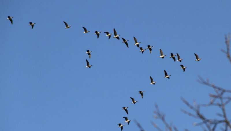
Using measurements from ESA’s Swarm mission, scientists have developed a new tool that links the strength and direction of the magnetic field to the flight paths of migrating birds, such as greater white-fronted geese. This is a huge step forward to understanding how animals use Earth’s magnetic field to navigate vast distances. Credit: OtsoTA/Wikimedia Commons, CC BY-SA 3.0 IGO
Using measurements from ESA's Earth Explorer Swarm mission, scientists have developed a new tool that links the strength and direction of the magnetic field to the flight paths of migrating birds. This is a huge step forward to understanding how animals use Earth's magnetic field to navigate vast distances.
These days, it is almost unimaginable for us to set off on a long journey without being equipped with some form of satellite navigation, or at least a map. Migratory animals, however, manage to cross entire oceans and continents, navigating with exceptional skills of their own. In spite of decades of research, we still do not understand fully how these remarkable animals are able to find their way—although it has been suspected that Earth's magnetic field lines are among the cues that guide them.
Recent advances in GPS and the miniaturization of tracking devices have allowed ecologists to tag migratory animals, from birds to whales, to understand how they travel from A to B. However, while animal tracking data are now common, little investigation has been made into how animals respond to real geomagnetic conditions, since the magnetic field changes continuously across the globe, particularly during geomagnetic storms.
Until recently, there was no way to assess accurately the strength of the magnetic field at the time and location that animals pass by, which would allow ecologists to study how they use this natural force for navigation.
However, a new tool allows ecologists, for the first time, to compute the strength and direction of the magnetic field along animal migratory paths.
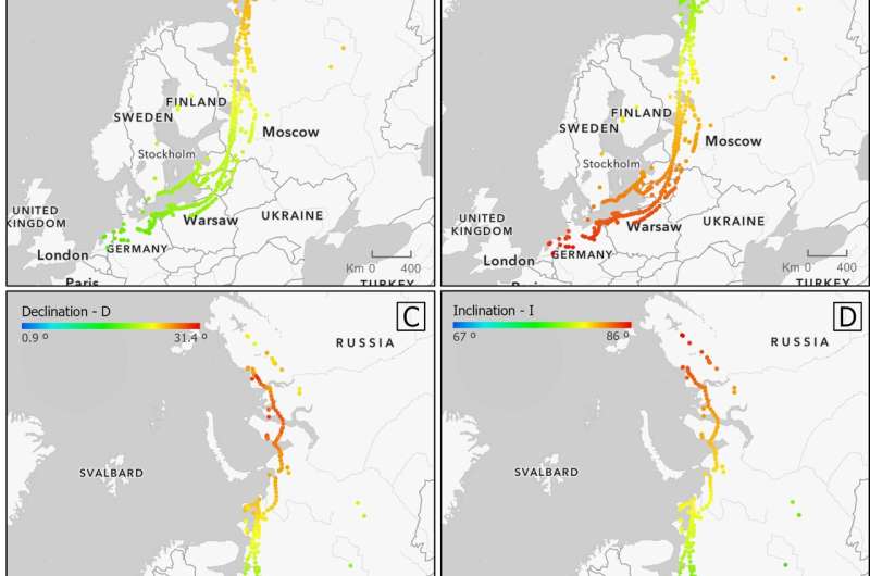
Using measurements from ESA’s Swarm mission, scientists have developed a new tool that links the strength and direction of the magnetic field to the flight paths of migrating birds, such as greater white-fronted geese. This is a huge step forward to understanding how animals use Earth’s magnetic field to navigate vast distances. The image shows the values of geomagnetic intensity that the geese encountered on their journeys. These maps show real values that the geese encountered on their migration from Siberia to Germany. Credit: Urška Demšar, University of St Andrews
Developed by spatial data scientists from the University of St Andrews in Scotland in collaboration with researchers from the British Geological Survey and Canada's University of Western Ontario, the new tool combines data from ESA's Swarm magnetic field mission with data stored in Movebank. Movebank is a free database of millions of locations and times of birds and mammals, such as bats and whales, on the move.
The research, which has been published recently in Movement Ecology, explains how the values were computed and gives examples applied to greater white-fronted geese, which fly from Siberia to Germany on their autumn migration.
The image above shows values of geomagnetic intensity that they encountered on their journeys.
Urška Demšar, from the University of St Andrews, explains, "We used the time and GPS locations of the animal to find the nearest Swarm data. This then let us compute the expected magnetic field at the animal's location due to the magnetic field generated by Earth's core, and accounted for local influence from the geology and the instantaneous effect of the ionosphere and magnetosphere.
"These contributions were summed and appended to the GPS data, including Swarm measurements from the nearest satellite flyovers for each GPS location. This gives us the best possible estimate of the magnetic field at the animal's location."
Using measurements from ESA’s Swarm mission, scientists have developed a new tool that links the strength and direction of the magnetic field to the flight paths of migrating birds, such as greater white-fronted geese. This is a huge step forward to understanding how animals use Earth’s magnetic field to navigate vast distances. The image shows data from nearby Swarm overpasses, which were funnelled down to the GPS tracking points of migratory animals. Credit: Urška Demšar, University of St Andrews
This new research means that the study of animal movement can now combine tracking data with geophysical information and lead to new insights on migration behavior.
This is demonstrated in the Movement Ecology paper by a small biological example, which shows that during geomagnetic storms, the geese were affected and generally veered away from the straight migratory direction towards the North. This is just a small example that cannot yet be generalized, but it shows the possibilities that are now open for study of animal migration with contemporaneous real magnetic data.
Without the availability of Swarm data, models and the supporting software (viresclient), it would not have been possible to create such an easy-to-use tool for analysis.
"This is the first direct use of Swarm data in ecology and so represents an exciting new avenue of research between geophysicists, spatial data scientists and ecologists," notes Ciarán Beggan from the British Geological Survey.
Dr. Demšar emphasizes that, "Adding in a new set of magnetic data will allow us to explore how animals migrate using a whole new set of environmental parameters that was unavailable before Swarm."
More information: Fernando Benitez-Paez et al, Fusion of wildlife tracking and satellite geomagnetic data for the study of animal migration, Movement Ecology (2021). DOI: 10.1186/s40462-021-00268-4
Provided by European Space Agency


