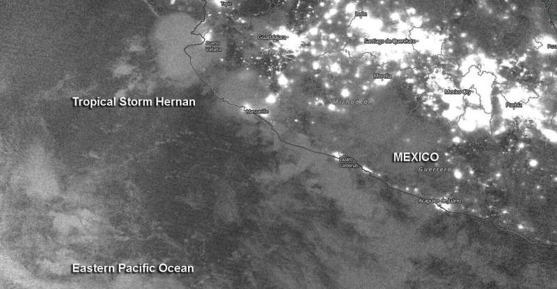
NASA-NOAA's Suomi NPP satellite passed the Eastern Pacific Ocean overnight on Aug. 26 at 10 p.m. EDT (Aug. 27 at 0000 UTC) and captured a nighttime image of Tropical Storm Hernan along the western coast of Mexico. Credit: NASA Worldview, Earth Observing System Data and Information System (EOSDIS)
Nighttime imagery from NASA-NOAA's Suomi NPP satellite revealed the Eastern Pacific Ocean's Tropical Storm Hernan along the coast of western Mexico. By the weekend, Hernan is expected to absorb nearby Tropical Storm Iselle.
Tropical Depression 13E formed by 5 a.m. EDT on Aug. 26 in the Eastern Pacific. Twelve hours later it strengthened to a tropical storm and was renamed Hernan.
NASA's Night-Time View
The Visible Infrared Imaging Radiometer Suite (VIIRS) instrument aboard Suomi NPP provided a nighttime image of Hernan on Aug. 26 at 10 p.m. EDT (Aug. 27 at 0000 UTC).
At 5 a.m. EDT on Aug. 27, the National Hurricane Center noted, "Although Hernan is a sheared tropical cyclone, another strong burst of deep convection with cloud tops of minus 83 to minus 86 degrees Celsius has developed near and south through west of the center." NASA research has shown that cloud tops that cold have the ability to generate heavy rainfall. By 11 a.m. EDT, first light visible satellite imagery reveals that Hernan remains a sheared tropical cyclone with most of the deep convection confined to the western semicircle.
Hernan's Status of Aug. 27
At 11 a.m. EDT (1500 UTC) NOAA's National Hurricane Center noted the center of Tropical Storm Hernan was located near latitude 19.1 degrees north and longitude 106.2 degrees west. That is 95 miles (155 km) southwest of Cabo Corrientes, Mexico. Hernan was moving toward the north-northwest near 5 mph (7 kph). Maximum sustained winds are near 45 mph (75 km/h) with higher gusts. The estimated minimum central pressure is 1001 millibars.
Hernan's Forecast Track
NHC predicts Hernan will turn to the northwest, along with an increase in forward speed is expected to occur by tonight. A turn to the west is forecast this weekend. On the forecast track, the center of Hernan, along with the strongest winds and heaviest rains, is expected to remain just offshore of the southwestern coast of Mexico. Nearby Tropical Storm Iselle is expected to begin weakening on Friday, and the system is forecast to degenerate into a remnant low-pressure area on Saturday. Iselle's remnants are expected to be absorbed by the circulation of Hernan to its west on Sunday.
Provided by NASA's Goddard Space Flight Center


