NASA finds Jangmi now an Extra-Tropical Storm

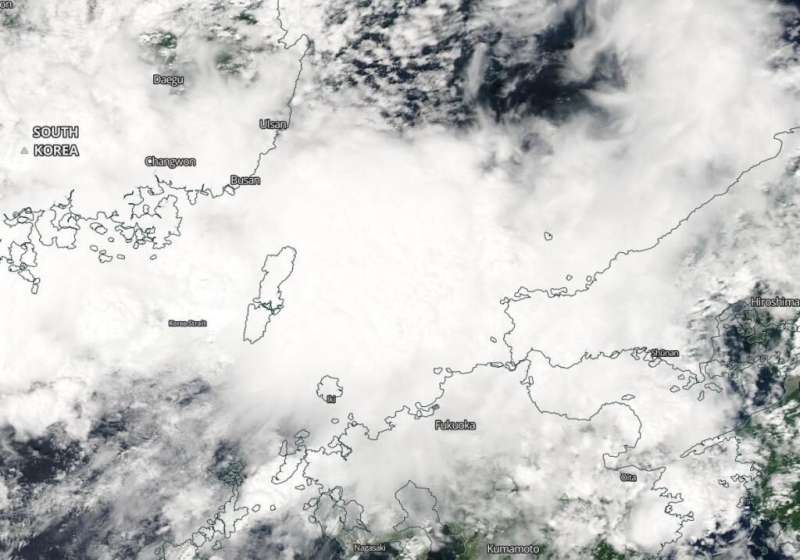
NASA's Aqua satellite obtained a visible image of Tropical Storm Jangmi after it transitioned into an extra-tropical storm.
The Joint Typhoon Warning Center (JTWC) posted its final bulletin on Tropical Storm Jangmi on Aug. 10 at 11 a.m. EDT (1500 UTC). At that time, it was located near latitude 26.9 degrees north and longitude 130.4 degrees east, about 139 miles northeast of Chinhae, South Korea. Jangmi was speeding to the north-northeast at 29 knots and had maximum sustained winds of 35 knots (40 mph).
On Aug. 11, Jangmi had moved into the Sea of Japan and had become extra-tropical.
What an Extra-tropical Storm Means
When a storm becomes extra-tropical, it means that a tropical cyclone has lost its "tropical" characteristics. The National Hurricane Center defines "extra-tropical" as a transition that implies both poleward displacement (meaning it moves toward the north or south pole) of the cyclone and the conversion of the cyclone's primary energy source from the release of latent heat of condensation to baroclinic (the temperature contrast between warm and cold air masses) processes. It is important to note that cyclones can become extratropical and retain winds of hurricane or tropical storm force.
The Moderate Resolution Imaging Spectroradiometer or MODIS instrument that flies aboard NASA's Aqua satellite captured a visible image of extra-tropical storm Jangmi in the Sea of Japan, near the Korea Strait. The Korea Strait is located between South Korea and Japan, connecting the East China Sea, the Yellow Sea and the Sea of Japan. The MODIS image showed that the storm had become somewhat elongated. Satellite imagery was created using NASA's Worldview product at NASA's Goddard Space Flight Center in Greenbelt, Md.
On Aug. 11, the Japan Meteorological Agency posted advisories along the prefectures in the Sea of Japan as Jangmi is forecast to move through it in a north-northeasterly direction and weaken.
About NASA's Worldview and Aqua Satellite
NASA's Earth Observing System Data and Information System (EOSDIS) Worldview application provides the capability to interactively browse over 700 global, full-resolution satellite imagery layers and then download the underlying data. Many of the available imagery layers are updated within three hours of observation, essentially showing the entire Earth as it looks "right now."
NASA's Aqua satellite is one in a fleet of NASA satellites that provide data for hurricane research.
Tropical cyclones/hurricanes are the most powerful weather events on Earth. NASA's expertise in space and scientific exploration contributes to essential services provided to the American people by other federal agencies, such as hurricane weather forecasting.
More information: For updated warnings and watches, visit: www.jma.go.jp/en/warn/
Provided by NASA's Goddard Space Flight Center


