NASA analyzes new eastern Pacific Ocean Tropical Depression 7E

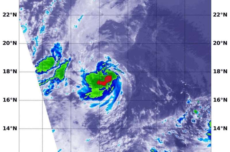
The seventh tropical depression of the Eastern Pacific Ocean has formed. NASA's Terra satellite used infrared light to identify the area of strongest storms and coldest cloud top temperatures in Tropical Depression 7E.
Tropical Depression 7E formed in the Eastern Pacific Ocean well to the southwest of Mexico's Baja California Peninsula. However, the storm is expected to be short-lived because it is expected to track over waters too cool to maintain it. Tropical cyclones need sea surface temperatures of at least 26.6 degrees Celsius (80 degrees Fahrenheit) to maintain strength.
On July 20 at 2:30 a.m. EDT (0630 UTC), the Moderate Resolution Imaging Spectroradiometer or MODIS instrument aboard NASA's Terra satellite analyzed Tropical Depression 7E's cloud tops in infrared light. Infrared data provides temperature information, and the strongest thunderstorms that reach high into the atmosphere have the coldest cloud top temperatures. Terra found one small area where temperatures were as cold as or colder than minus 70 degrees Fahrenheit (minus 56.6 Celsius) in the southeastern quadrant. Cloud top temperatures that cold indicate strong storms with the potential to generate heavy rainfall.
At 5 a.m. EDT (0900 UTC), the center of Tropical Depression 7E was located near latitude 18.0 degrees north and longitude 129.3 degrees west. That is about 1,300 miles (2,090 km) west-southwest of the southern tip of Baja California. The National Hurricane Center (NHC) reported that the depression is moving toward the northwest near 12 mph (19 kph), and this motion is expected to continue through Monday night, followed by a turn the west by early Tuesday. Maximum sustained winds are near 35 mph (55 kph) with higher gusts. The estimated minimum central pressure is 1007 millibars.
NHC Forecaster Stacy Stewart noted, "Although the vertical wind shear is expected to remain low at less than 5 knots for the next 24 hours or so, the small cyclone is already moving over sub-26 degree Celsius sea-surface temperatures (SST), with slightly cooler water ahead of the system. The ingestion of cooler and drier air, along with the cool SSTs, is expected to weaken the system below depression status by 24 hours."
Little if any change in strength is forecast during the next 48 hours. The depression is expected to be a short-lived tropical cyclone that will degenerate into a remnant low by Tuesday morning.
Provided by NASA's Goddard Space Flight Center


