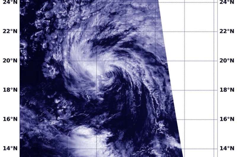
NASA-NOAA’s Suomi NPP satellite provided a visible image of Tropical Depression 7E on Monday, July 20 at 6:36 p.m. EDT (2236 UTC) and revealed it was devoid of strong thunderstorms and being affected by easterly wind shear. Credit: NASA Worldview, Earth Observing System Data and Information System (EOSDIS)
NASA-NOAA's Suomi NPP satellite passed over the Eastern Pacific Ocean and provided forecasters with a visible image of the waning Tropical Depression 7E. Wind shear and cooler waters were taking their toll on the storm.
The Visible Infrared Imaging Radiometer Suite (VIIRS) instrument aboard Suomi NPP provided a visible image of the storm on Monday, July 20 at 6:36 p.m. EDT (2236 UTC) and revealed it was devoid of strong thunderstorms. The VIIRS image showed that the only deep convection associated with the depression was a small shapeless patch of clouds pushed about 70 miles to the west of the poorly defined surface center of circulation.
Vertical wind shear, that is, winds outside of a tropical cyclone at different heights in the atmosphere (the troposphere), pushes against a tropical cyclone and tears it apart. Tropical Depression 7E is being battered by easterly winds. The system is also moving over waters too cool to maintain strength. Tropical cyclones need sea surface temperatures of at least 26.6 degrees Celsius (80 degrees Fahrenheit) and 7E is moving through waters as cool as 24 to 25 degrees Celsius (75.2 to 77 degrees Fahrenheit).
At 5 a.m. EDT (0900 UTC) on July 22, the National Hurricane Center (NHC) found center of Tropical Depression 7E near latitude 19.3 degrees north and longitude 133.0 degrees west. That is about 1,505 miles (2,425 km) west of the southern tip of Baja California, Mexico. The depression was moving toward the west near 13 mph (20 kph), and this general motion is expected to continue for the next day or so. Maximum sustained winds are near 35 mph (55 kph) with higher gusts.
At that time, NHC said, "The system is forecast to become a remnant low within the next few hours. The winds associated with the remnant low should gradually diminish during the next day or two until the system dissipates."
Satellite imagery on July 22 revealed that 7E does not have any strong thunderstorms, and is now devoid of all deep convection. If deep convection does not redevelop soon, it will become a remnant low early Tuesday.
Tropical cyclones/hurricanes are the most powerful weather events on Earth. NASA's expertise in space and scientific exploration contributes to essential services provided to the American people by other federal agencies, such as hurricane weather forecasting.
Provided by NASA's Goddard Space Flight Center


