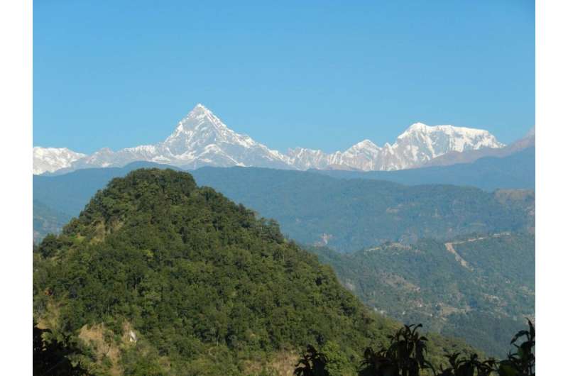
The majestic pyramid of Machapuchare (Fish Tail) dominating the wooded hills of the Lesser Himalaya from its height of 7,000 meters. Credit: Jérôme Lavé
Researchers from Centre de Recherches Pétrographiques et Géochimiques (CNRS / University of Lorraine), in collaboration with CEREGE have shown that erosion in the Himalayas is primarily governed by tectonic movements, which would limit the impact of climate change on the formation of Himalayan landscapes. Their study was published in Nature Geosciences on June 1, 2020.
The Himalayas offer spectacular landscapes and present both the highest peaks and the deepest valleys in the world. This mountain range has formed since the Indian and Eurasian plates began to collide. There, the Indian Monsoon produces intense seasonal precipitations, and glaciers cover the landscapes at elevations higher than 5,000 m. As these climatic conditions combine with active tectonic uplift, dynamic rivers and glaciers produce extreme erosion in the Himalayas. During the Quaternary (0—2.6 Ma), climatic and glacial cycles developed, glaciers advanced and retreated regularly, and river discharge fluctuated similarly. Thus, the capacity of rivers and glaciers to erode may have varied, which, in turn, may have affected the rate of erosion of the landscapes. Glaciers were on average much more extended during the Quaternary than in previous periods. Glacial increased extent is supposed to have led to a sharp increase in erosion in mountain ranges. But in the Himalayas, earthquakes, landslides and river incision quickly erase the markers of glacial advances and retreats, and few clues remain to validate these hypotheses.
Researchers began the study of this erosion by carrying out an underwater drilling in 2015 initiated by C. France-Lanord (CRPG), in collaboration with the University of Bremen (Germany). The samples were then analyzed by CRPG and CEREGE researchers as part of the thesis of Sébastien Lénard, doctoral student at the CRPG. To determine past erosion rates, these researchers measured the concentration of beryllium 10 (10Be) accumulated in the quartz crystals that make up these sediments. As a cosmogenic nuclide, 10Be is a nuclide produced during the nuclear interaction between high-energy particles from cosmic radiation and the atoms of the minerals of rocks close to the earth's surface. Because cosmic ray particles are very effectively attenuated by matter, the production of these nuclides in minerals directly depends on the depth of rocks below the earth's surface.
For example, at 40 cm below the surface, the production of 10Be is half the production for a mineral at the surface. When a mountain slope or soil is eroded, a rock initially located a few meters underground approaches the surface and accumulates cosmogenic nuclides in its minerals. This accumulation depends directly on the rate of erosion of the surface: for a rapidly eroding surface, the rock is rapidly approaching the surface, and its minerals do not have time to accumulate a high concentration of 10Be. Using this property, earth scientists get a relatively direct tool for estimating erosion rates.
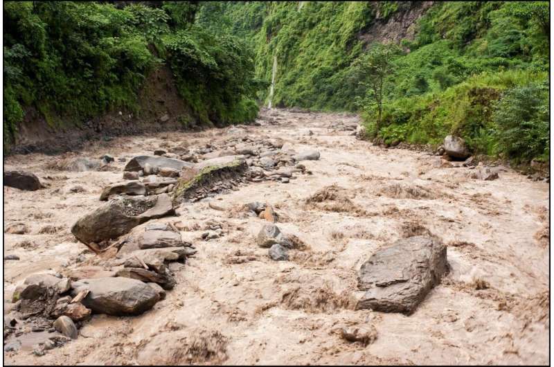
Highly sediment loaded Himalayan river after an intense monsoon rainfall event (Khudi river in central Nepal). Credit: Maarten Lupker
Unexpectedly, during the past six million years, the erosion rates are on average very close to the modern erosion rates in the Himalayas, around 1 mm/year. They neither show an increasing trend nor a decreasing trend at the Quaternary transition, despite the marked increase in glacier extension and glacial erosion in the Himalayas since this transition. These results suggest that tectonic movements have a major control on erosion in the Himalayas, and that climatic changes would have only a limited impact on the formation of the Himalayan landscapes.
More information: Sebastien J. P. Lenard et al. Steady erosion rates in the Himalayas through late Cenozoic climatic changes, Nature Geoscience (2020). DOI: 10.1038/s41561-020-0585-2
Journal information: Nature Geoscience
Provided by Université de Lorraine


