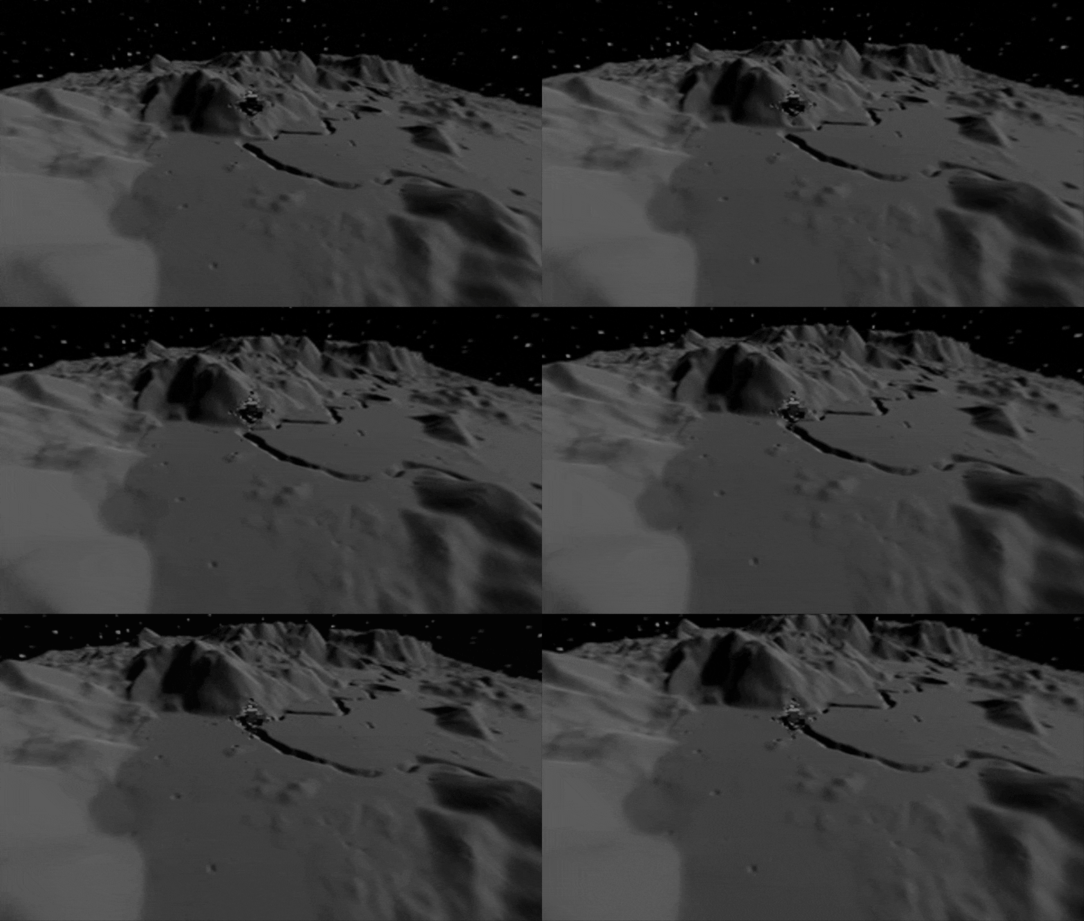
1971's Apollo 15 was among the most ambitious of the six lunar landings: the Falcon Lunar Module had to cross a mountain range that rises higher than the Himalayas before landing beside Hadley Rille, an elongated canyon-like channel. A team based at ESA’s ESAC astronomy centre in Spain, working with UK company Timelab Technologies, has recreated the landing using SPICE software, integrating a high-resolution lunar model. Credit: ESA
If someone had been watching as Apollo 15's Falcon Lunar Module headed down beside the moon's Appenine mountains in 1971, then this is what they would have seen. ESA researchers, working with UK company Timelab Technologies, are recreating historic missions to the moon in high-definition 360 virtual reality, as a way of gaining new insights from vintage instrument data—as well as helping plan new missions for later this decade.
Apollo 15 was among the most ambitious of the six lunar landings, crossing a mountain range that rises higher than the Himalayas before landing beside Hadley Rille, an elongated canyon-like channel.
"We are revisiting these missions to recreate their detailed attitude history as a way to re-analyze various scientific measurements they made, such as optical imaging or X-ray spectroscopy," explains ESA project scientist Erik Kuulkers. "By combining positioning data with a highly detailed digital elevation model of the lunar surface, we can know exactly what the instruments were pointing at as they record their results.
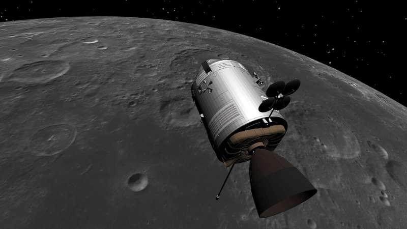
"To begin with we chose Apollo 15 as the first of the science-focused crewed "J-type missions' to the moon, which carried additional scientific payloads—including remote sensing instruments to observe the lunar surface from the Command Service Module (CSM) in orbit—for longer stays. In addition we have simulated ESA's 2003 SMART-1 to the moon, which tested solar electric propulsion while performing scientific observations of the lunar surface."
A SPICE simulation of Apollo 15's Command and Service Module in orbit around the moon in 1971. As the first in the J-type Apollo missions to the moon, the Module carried additional remote sensing instruments. Simulating its trip using a high-resolution digital model of the moon helps extract fresh insights from their data. Credit: ESA
The project, based at ESA's ESAC astronomy center in Spain, is making use of specialist software called SPICE, used to plan and interpret planetary observations. The name is a summary of its functionality: "S' for spacecraft, "P' for planet (or more generally target body), "I' for instrument information, "C' standing for orientation information and "E' for events, meaning mission activities, both planned and unplanned.
While the software is developed by NASA's Jet Propulsion Laboratory, ESA runs its own SPICE Service at ESAC, and uses it to plan observations and analyze data for missions such as Mars Express, Venus Express, Rosetta,the ExoMars Trace Gas Orbiter and the ESA-JAXA BepiColombo to Mercury—including simulating its recent Earth flyby. This new project demonstrates that an equivalent analysis can be performed for older missions still.
ESA SPICE Service engineer Alfredo Escalante López explains: "For Apollo 15, its orbit around the moon was constructed taking positions and velocities recorded in auxiliary data from the Gamma Ray Spectrometer, studying the composition of the lunar surface. Then the pointing of the instruments was derived using additional attitude information from another instrument, the X-Ray Fluorescence Spectrometer.
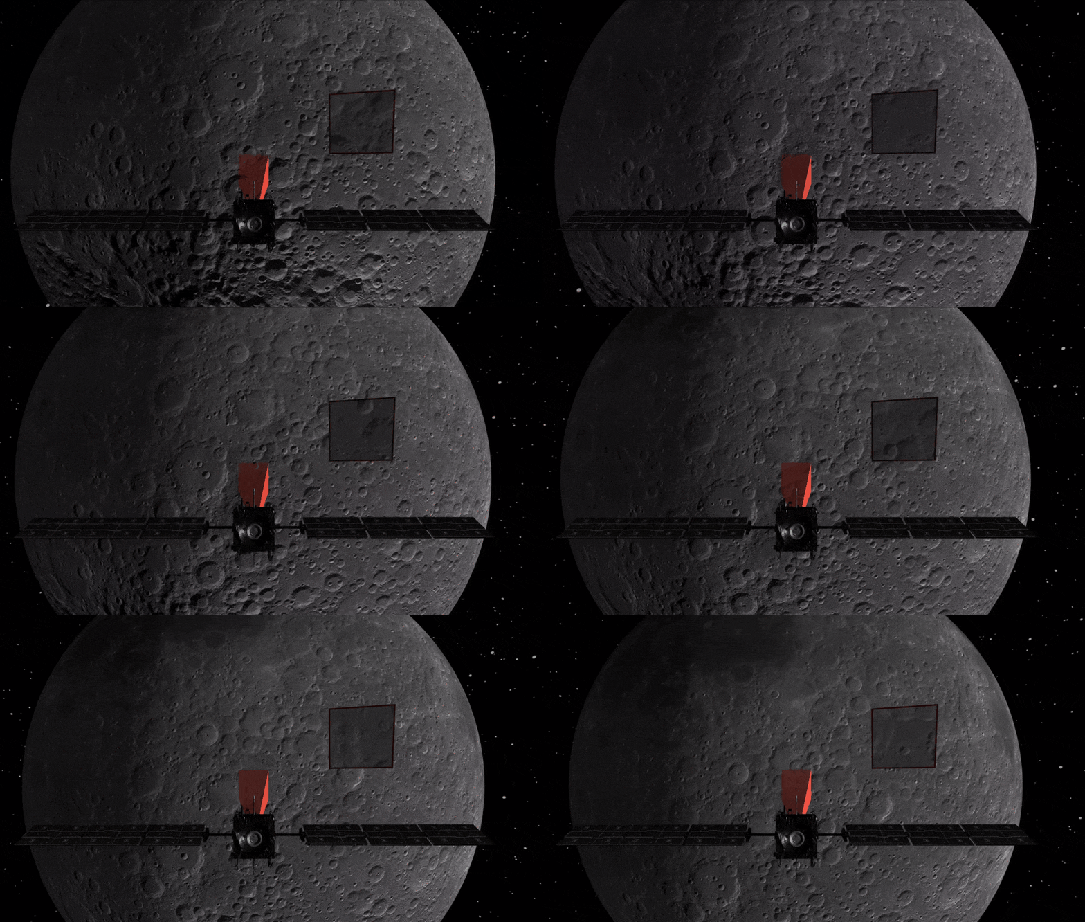
SMART-1 in orbit. Credit: European Space Agency
"These two instruments were mounted together in the Scientific Instrument Module (SIM) of CSM. To check the accuracy of our recreation we went on to compare images gathered by the visible-light Mapping Camera, also in the SIM with our artificially-generated views.
"The same end-to-end process was applied to the SMART-1 orbiter, resulting in real-time rendering of the lunar surface that could be compared to the imagery captured at the time by the Advanced Moon micro-Imager Experiment, AMIE, aboard the spacecraft."
The lunar digital elevation model employed for this project is of the highest possible accuracy, down to a minimum resolution of just 5 m, combining terrain elevation measurements from laser altimeters aboard NASA's Lunar Reconnaissance Orbiter and the Japan Exploration Aerospace Agency's Kaguya with optical views from LRO's Wide and Narrow Angle Cameras.
"Getting to know the moon so well is of much more than simply historical interest," adds ESA operations scientist Simone Migliari.
"ESA's Pilot navigation system will use feature tracking techniques akin to facial recognition software to guide future missions down to some of the most challenging terrain on the moon. This will start with Russia's Luna-27, headed to the south polar region in 2025, where it will carry an ESA-made payload called Prospect, with a robotic drill to search out lunar water ice and resources."
The team have also visualized key aspects of the missions they're studying in high-precision 3-D scenarios for public consumption, including Apollo 15's lunar orbit, its LM landing and a drive around the landing site on the Lunar Rover.
ESA SPICE Service coordinator Marc Costa Sitjà says: "We aim to provide new ways of displaying and validating scientific measurements, while also offering a new immersive way for the general public to relive the excitement of these legacy missions."
More information: Download a collection of the team's 360 VR recreations here: bitbucket.org/alfredoescalante … ryimager/src/master/
Provided by European Space Agency


