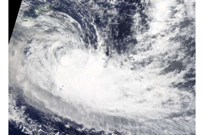
NASA tracks Tropical Storm Sarai moving away from Fiji

NASA's Terra satellite passed over the Southern Pacific Ocean on Dec. 30 and found that Tropical Storm Sarai continued to move further away from Fiji and toward Tonga.
On Dec. 30, 2019, the Moderate Imaging Spectroradiometer or MODIS instrument that flies aboard NASA's Terra satellite provided a visible image of Sarai that showed the storm had flaring convection and strongest thunderstorms around the low-level center. The storm also appeared elongated indicating it was weakening.
On Dec. 30 at 10 a.m. EST (1500 UTC), the Joint Typhoon Warning Center noted that Tropical Cyclone Sarai was located near 22.1 degrees south latitude and 176.4 degrees west longitude. That is about 403 nautical miles west-southwest of Niue. Maximum sustained winds 45 knots (52 mph) and weakening.
Sarai is forecast to curve to the northeast and pass just north of Tonga and Niue over the next several days. Both of those islands can expect rough surf, tropical storm force winds and heavy rains. As this storm continues tracking in an easterly direction the Joint Typhoon Warning Center expects vertical wind shear, or outside winds to increase, leading to a weakening trend.
Provided by NASA's Goddard Space Flight Center


