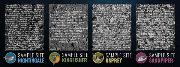
Four candidate sample sites were initially marked by the names superimposed on these images, and then higher-resolution imagery was marked by our 7 most prolific mappers, MikeCassidy, Nilium, bc2callhome, zathras, joed, dpi209, and pattyg. Credit: Created using sources images from NASA/Goddard/University of Arizona
When NASA's OSIRIS-REx mission spacecraft arrived at the asteroid Bennu, it discovered more rocks and boulders than envisioned. Mapping all these potential hazards was necessary to select a location to collect a sample of the surface for return to Earth. This effort was the work of multiple teams around the globe. One of those teams consisted of more than 3,500 citizen scientists who used CosmoQuest's Bennu Mappers project to mark rocks, measure boulders, and map craters. Together, they made more than 14 million annotations of features on a global map of Bennu. CosmoQuest is a project that is based at the Planetary Science Institute in Tucson, Ariz. (CosmoQuest.org).
These volunteers had no way of knowing in advance if the sites they studied and mapped would be the one selected as the final sampling site for the OSIRIS-REx spacecraft. Folks who saw images with fewer rocks could hope "This is it!" But first, they had to first mark all the photos with hundreds of rocks and dozens of boulders so mission scientists could choose the images critical to site selection.
"It is amazing that more than 3,500 citizen scientists participated in CosmoQuest's project to map Bennu and help mission scientists find the best place for OSIRIS-REx to collect a sample," said Pamela L. Gay, Senior Scientist and Senior Education and Communication Specialist at PSI. "This kind of a volunteer effort makes it easier to find safe places to sample and scientifically interesting places to explore."
While the majority of people marked fewer than 10 images from the global mosaic, 68 volunteers marked 100 to 500 images, and 23 marked more than 500 pictures! Each image took as much as 45 minutes to complete, and these people put in weeks of individual effort during the four months it took to map this world.
-
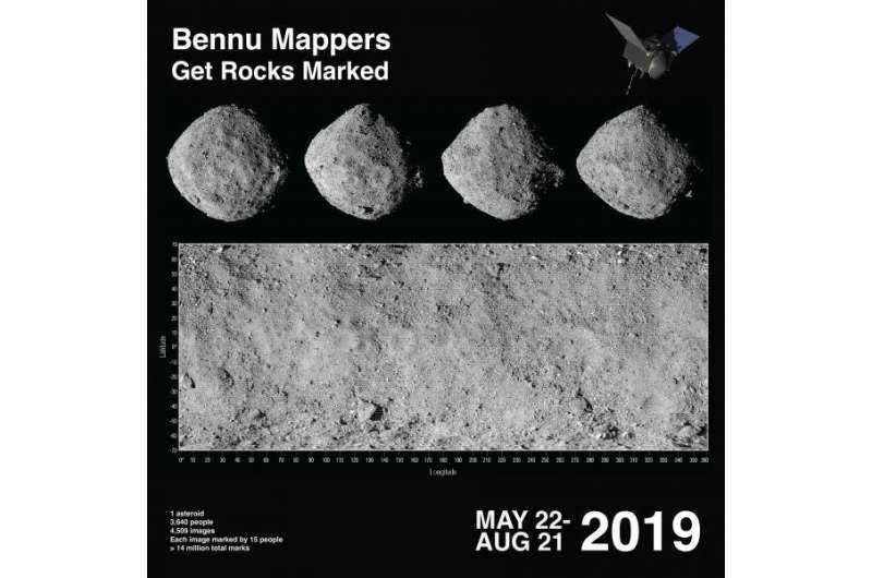
All 3,640 names of the Bennu Mappers are superimposed on this Global Mosaic of the Bennu Asteroid that was acquired by the OSIRIS-REx Mission. Credit: Created using sources images from NASA/Goddard/University of Arizona
-
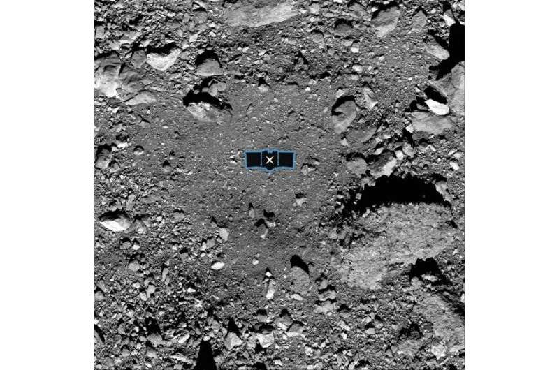
This image shows sample site Nightingale, OSIRIS-REx’s primary sample collection site on asteroid Bennu. The image is overlaid with a graphic of the OSIRIS-REx spacecraft to illustrate the scale of the site. Credit: NASA/Goddard/University of Arizona
With experience came improved measuring expertise, and the seven most active mappers, individuals who marked 1,000 images or more, mapped with accuracy similar to that of science team members. These volunteers—MikeCassidy, Nilium, bc2callhome, zathras, joed, dpi209, and pattyg—aided in mapping out the highest resolution images taken of the four areas selected as potential sample sites.
This project doesn't end with sample site selection. In the coming weeks and months, the CosmoQuest Team at PSI will be continuing to work with the Bennu Science Team to generate maps and science from the citizen science data. Some citizen scientists will be receiving credit by name for their validated contributions.
CosmoQuest launched in January 2012 and was the first citizen science site to produce publishable surface science results. People who missed mapping Bennu can join CosmoQuest today and help map out the Moon as part of a machine learning project. CosmoQuest is in the process of transitioning to use entirely open source software and will launch new planetary citizen science projects in 2020.
More information: An image showing the usernames of everyone involved in this project is available at drive.google.com/file/d/1FY9qm … YmX/view?usp=sharing
Provided by Planetary Science Institute


