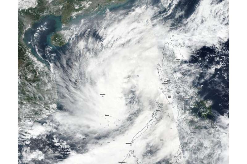
On Nov. 6, 2019, the VIIRS instrument aboard NASA-NOAA’s Suomi NPP provided a visible image of Nakri that showed that it appeared more circular in shape than in the previous 24 hours, but the strongest convection was occurring west of the center. Credit: NASA Worldview, Earth Observing System Data and Information System (EOSDIS) / NOAA
NASA-NOAA's Suomi NPP satellite passed over the South China Sea and captured a visible image of newly formed Tropical Storm Nakri while it remained quasi-stationary and as it slowly organized.
Nakri, known in the Philippines as Quiel, formed west of the central Philippines in the South China Sea part of the Northwestern Pacific Ocean. On Nov. 6, 2019, the Visible Infrared Imaging Radiometer Suite (VIIRS) instrument aboard Suomi NPP provided a visible image of Nakri. The VIIRS image showed it had become better organized and more circular over the previous 24 hours, although infrared satellite imagery revealed the strongest thunderstorms appeared to be displaced west of the center. The data provided valuable information to forecasters at the Joint Typhoon Warning Center.
On Nov. 6 at 4 a.m. EDT (0900 UTC), Tropical Cyclone Nakri's maximum sustained winds were near 35 knots (40 mph/65 kph). It was located near latitude 13.2 degrees north and longitude 116.4 degrees east, about 281 nautical miles west-southwest of Manila, Philippines. Nakri was quasi-stationary, moving very slowly to the east.
Forecasters at the Joint Typhoon Warning Center expect Nakri will move slowly east for the next day before turning west and heading toward Vietnam. The system is forecast to intensify to 50 knots (58 mph/93 kph) before making landfall in Vietnam on Nov. 10.
Hurricanes are the most powerful weather event on Earth. NASA's expertise in space and scientific exploration contributes to essential services provided to the American people by other federal agencies, such as hurricane weather forecasting.
Provided by NASA's Goddard Space Flight Center


