Land use planning prevents misuse of natural resources in Tanzania

Together with local experts, researchers of the University of Turku, Finland, developed a geospatial mapping method for local level land use planning in Tanzania, based on high-resolution satellite images. Involving the local communities and including their needs in the planning process creates sustainable and transparent practice of spatial planning in Tanzania.
The researchers of the University of Turku studied land use and the structure-function-benefit chains in the landscape systems of the Tanzanian Southern Highlands in the four-year project funded by the Academy of Finland. The goal of the project was to develop research-based participatory digital tools and methods for land use planning. In Tanzania, digitalisation is moving forward quickly, which creates access to open geospatial data and digital working methods more efficiently and affordably than before.
"Digital geospatial data and technologies generate new solutions and business for Tanzania's rapidly developing market, especially if the business idea clearly fits the purpose, involves the locals, develops their agency, and has a positive influence on people's quality of life," says Associate Professor in Geospatial Research Niina Käyhkö from the Department of Geography and Geology.
Of the approximately 12,000 villages in the Tanzanian countryside, less than 15 percent currently have a land use plan that directs the sustainable use of land and natural resources. Therefore, Tanzania, like many other countries all over the world, needs to develop cost-effective and more transparent methods for land use planning.
"If there is no plan, situations can easily arise where the land and natural resources of local communities can be reallocated without the residents' consent. In these cases, there are no clear regulations for expanding agriculture or mining activities. When the locals are included in the planning, the end result corresponds to their needs and values better and will be more widely accepted. Up-to-date geospatial data of the planning area enables knowledge-based decision-making," says Doctoral Candidate in Geography Salla Eilola, who is writing her dissertation on the topic.
Representatives of Village Communities Are Now Actively Involved in Planning

In Tanzania, the researchers reviewed how participatory methods and geospatial information were used in the Village Land Use Planning process. The review was carried out in collaboration with a development co-operation project between Finland and Tanzania, the Private Forestry Programme (PFP).
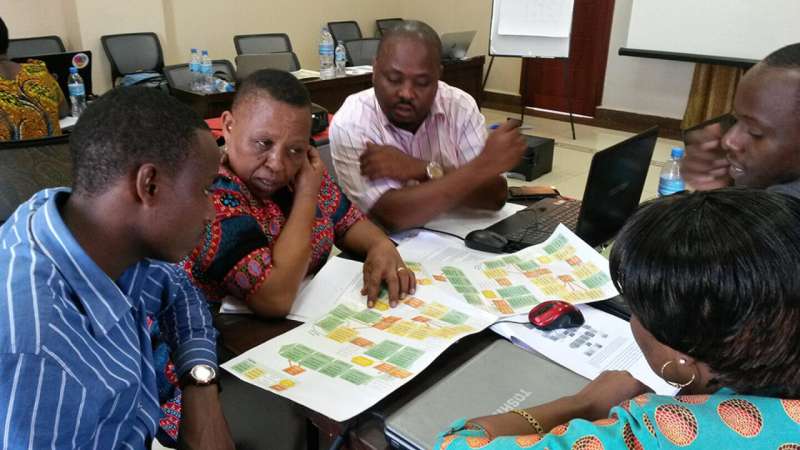
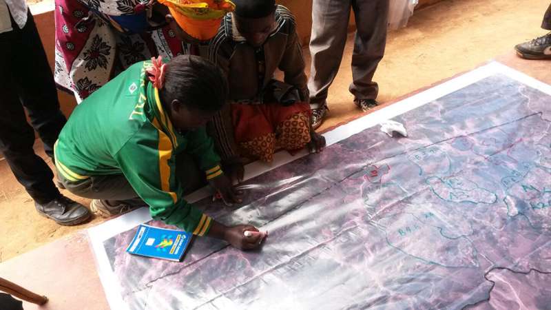
"On the basis of the review, we co-developed an improved participatory mapping method that uses satellite images and actively involves the representatives of village communities in the more detailed mapping and planning of the land use," says Eilola.
The National Land Use Planning Commission (NLUPC) of Tanzania got interested in the method and enabled it to be implemented more widely in the country. The researchers organised workshops for Tanzanian practitioners who are working on land use planning. As part of the workshops, a guideline was created that supports the adoption of the participatory mapping method in the entire country.
"Our mapping method based on the interpretation of high-resolution satellite images was well received among the planning officers in the Tanzanian district level. We also made a short documentary where Tanzanians share their thoughts and views on the method. For example, our method reduces the amount of field work, frees time for actual planning, and increases understanding on local-level land use," says Eilola.
However, according to Eilola, a wider adoption of the method requires training of the local actors and, from them, a long-term commitment to updating their skills on using digital tools. So far, training has been organised to planning officers in 16 districts in southern and eastern Tanzania by the development co-operation project and NLUPC.
"Our study is a good example of how collaboration with practitioners working at the grass roots level can quickly create new practices, which likely leads to development. Involving the local residents actively in decision-making supports their agency in finding sustainable solutions for land use," notes Eilola.
More information: Salla Eilola et al. A bird's eye view of my village – Developing participatory geospatial methodology for local level land use planning in the Southern Highlands of Tanzania, Landscape and Urban Planning (2019). DOI: 10.1016/j.landurbplan.2019.103596
Provided by University of Turku


