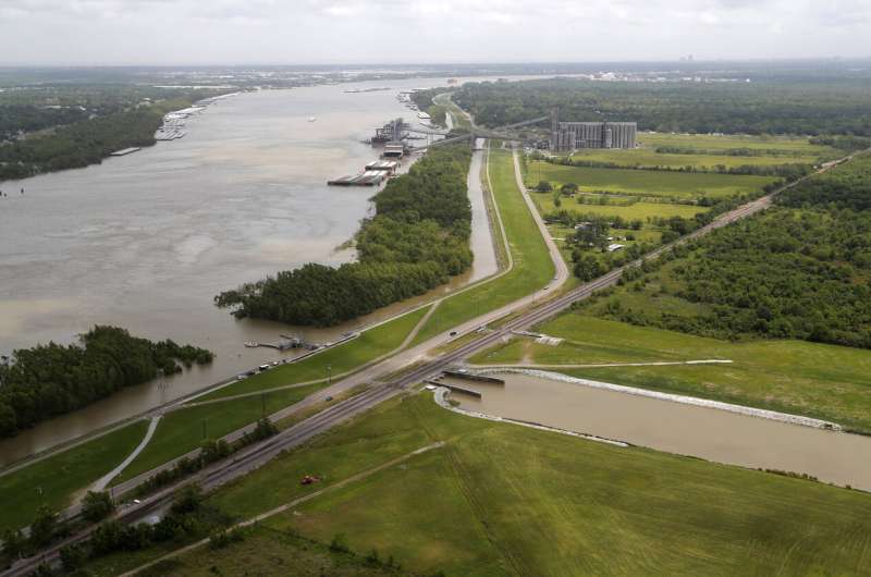
This May 1, 2019, photo, shows the Davis Pond Diversion, a project that diverts water from the Mississippi River, left, into the Barataria Basin to reduce coastal erosion in St. Charles Parish, La. Engineers hope to remake some eroded marshes by siphoning off sediment-rich water that can be channeled into coastal basins. (AP Photo/Gerald Herbert)
Back when the Mississippi River flowed wild, its ever-shifting waters acted as a continent-sized earth mover, picking up sand and dirt from the North, depositing it in the Delta region and eventually creating the land that is now south Louisiana.
Thousands of years later, the mighty river is held in check with man-made levees and flood-control systems. But Louisiana officials are making plans to tap into the Mississippi's ancient power to build new land as a way to reverse coastal erosion and ease the threat of rising seas.
Engineers hope to remake some eroded marshes by cutting into the levees and siphoning off sediment-rich water that can be channeled into coastal basins. When the sediment settles out of the water, it will slowly accrue into soil.
"The fundamental problem in coastal Louisiana is that lack of sediment, and so we're trying to mimic the way Mother Nature would have delivered that sediment to our coast in the past," said Bren Haase, who leads the state's Coastal Protection and Restoration Authority.
Some skeptics question whether the idea poses its own environmental risks. But if it works, the project will restore a crucial buffer against storm surges and offer new habitat for migratory birds and fish that rely on wetlands.
Saltwater is eating away at the coast, accelerated by a network of canals cut for oil and gas development, navigation and logging. The state estimates that it has lost just over 2,000 square miles of land—a tract about the size of Delaware—since 1932. If nothing is done, as much as 4,200 square miles could vanish over the next 50 years depending on sea level.
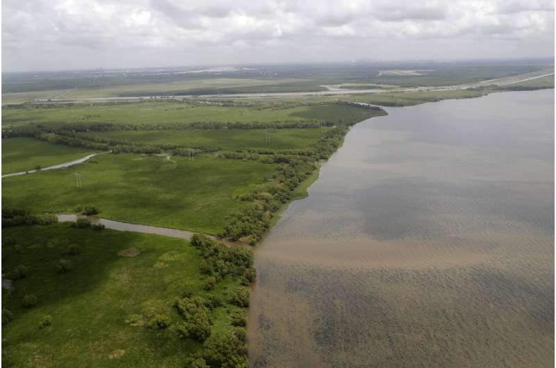
This May 1, 2019, photo shows the Davis Pond Diversion in St. Charles Parish, La. The project was built to channel freshwater from the Mississippi River into Barataria Bay to balance out rising salinity levels caused by encroaching water from the Gulf of Mexico. (AP Photo/Gerald Herbert)
Using the river to rebuild the coast has been discussed for decades, but it was not until settlement money from the 2010 BP oil spill became available that plans began in earnest. The explosion killed 11 people on a rig leased by BP and resulted in millions of gallons of oil spewing into the gulf for three months.
Louisiana is putting much of its share of the settlement toward coastal restoration, including spending a little more than $2 billion on two projects dubbed Mid-Barataria and Mid-Breton for the bodies of water in which they will be placed.
One of the key advantages of the sediment-diversion system is that it can operate continuously for decades, as opposed to dredging, which involves a onetime effort to scoop sediment from one location and deposit it in another.
"For a dredge project, we may be talking 100 acres, 200 acres or 1,000. We're doing some of the bigger dredge projects we've ever done before, but we're still talking low thousands. Diversions have the potential for tens of thousands of acres," said Brad Barth, sediment diversion program director with the CPRA.
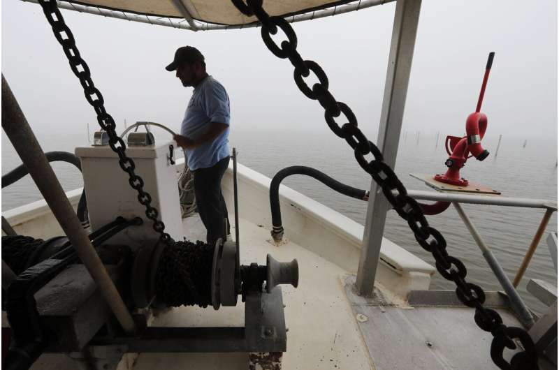
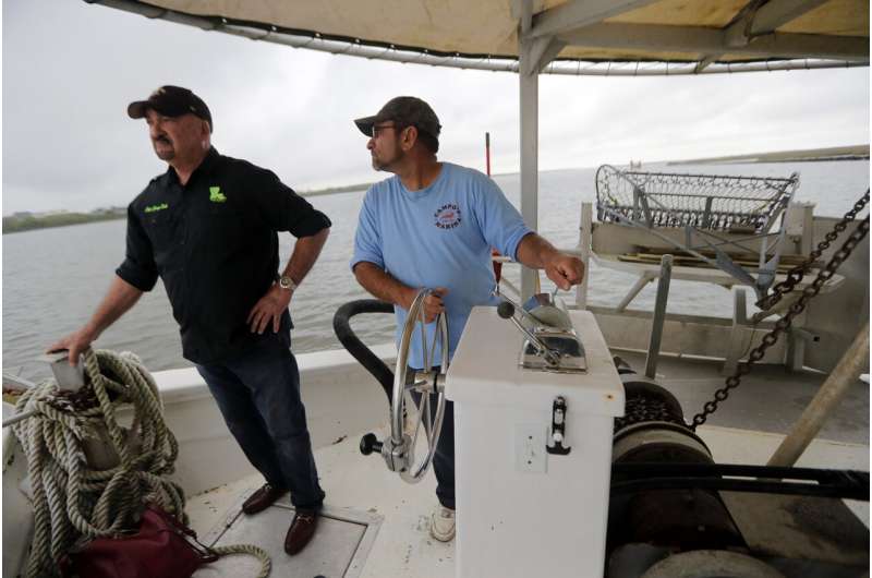
In this March 11, 2019, photo, Robert Campo, an oyster fisherman and marina owner, pilots his oyster boat from the dock in Yscloskey, La. Campo and others worry that plans to use the Mississippi River to rebuild eroded coastline will flood their fishing areas with dirty river water and destroy an industry vital to the state's economy and culture. (AP Photo/Gerald Herbert)
As the diverted river water drains from the basin, the sediment settles out and begins accumulating. Over time, it piles up, first under the water and then emerging above the surface. Eventually, vegetation such as marsh grass or willow trees can take root.
State officials are in the permitting process. The earliest start to construction would be in 2021 or 2022. But an airboat tour through the marshes created by an existing diversion project gives a hint of what might lie ahead.
The Davis Pond Diversion was built to channel freshwater from the Mississippi into Barataria Bay to balance out salinity levels that have risen as Gulf water encroached. The diversion carries a fraction of the water that the two larger projects will, and building land was not the goal but a happy byproduct.
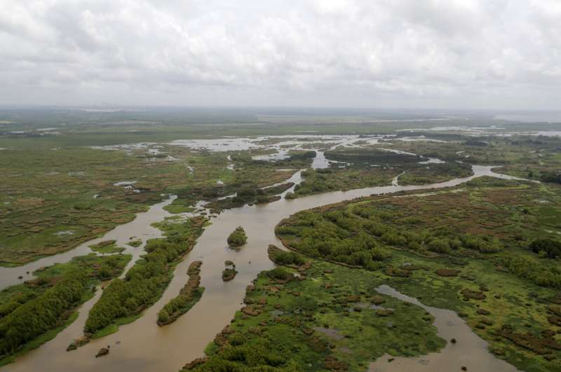
Where there used to be open water, grass and willows now grow on a ridge. The land is so dense that a person can walk on it—a major change in about a decade, said Rudy Simoneaux, a state coastal engineer.
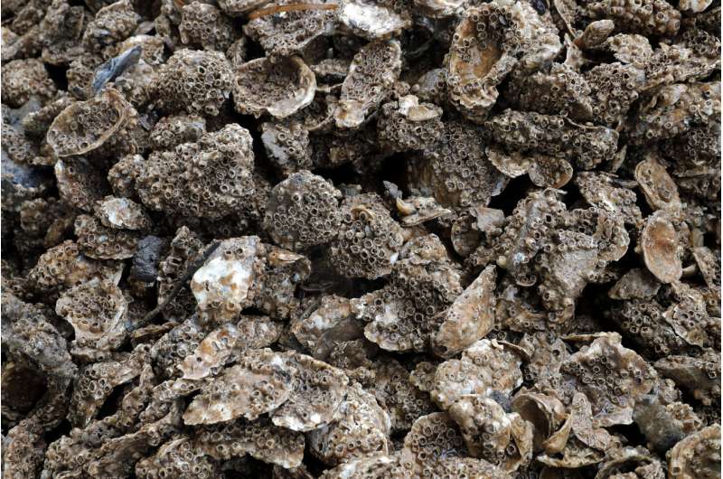
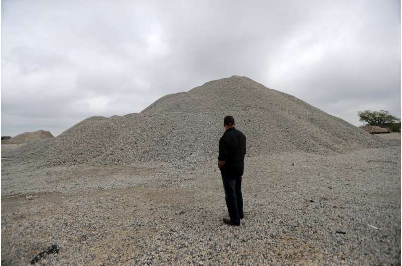
This March 11, 2019, photo shows material from what used to be a thriving oyster bed in Yscloskey, La. The area was inundated with freshwater as part of a plan to rebuild eroded coastline. (AP Photo/Gerald Herbert)
When it comes to the Mid-Barataria project, the time frame for land emerging above the surface would depend on a lot of factors such as water levels in the Mississippi. But Simoneaux said results could be evident in five years.
"I think you would see those natural ridges start to form, and you would see the woody formations happen just the same as here," he said.
Not everyone is as eager.
Robert Campo's family has been in the fishing industry since 1903. Fishermen still come to his dock in Shell Beach to buy brown shrimp for bait.
Campo and others worry the diversions will flood their fishing areas with dirty Mississippi river water, destroying an industry vital to the state's economy and culture. Shrimpers worry they'll have to travel much farther to fish; oystermen worry about losing millions of dollars invested in oyster reefs.
In this March 11, 2019, photo, Robert Campo, right, an oyster fisherman and marina owner, pilots his boat with George Ricks, president of the Save Louisiana Coalition, in Yscloskey, La. Campo and others worry that diverted Mississippi River water will flood their fishing areas with dirty water and destroy an industry vital to the state's economy and culture. (AP Photo/Gerald Herbert)
"We all want coastal restoration. Trust me, I'm a big advocate for it. I think we need to rebuild this whole coast. But there's other ways of doing it ... with minimal effects to our fisheries," Campo said.
Diversion opponents also point to recent flooding-fighting efforts on the Mississippi.
Fed by rain and melting snows in the Midwest, the Mississippi ran unusually high for months earlier this year. The Army Corps of Engineers twice opened the Bonnet Carre Spillway, which protects New Orleans' levees by channeling huge amounts of river water into normally brackish Lake Pontchartrain, a huge tidal basin that drains into the Gulf.
The sudden release of freshwater into saltwater ecosystems killed oysters, diminished fish catches and damaged livelihoods.
Skeptics question how much land will be built. R. Eugene Turner, a professor at LSU's Department of Oceanography and Coastal Sciences, has argued in a recent study that existing diversions—including Davis Pond—have led to overall land loss.
-
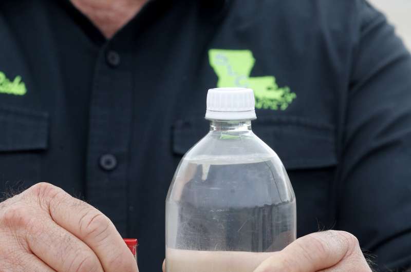
In this March 11, 2019, photo, George Ricks, president of the Save Louisiana Coalition, holds a sample of 700 mg of sediment next to a liter of water in Yscloskey, La. That is the amount of sediment he says 1 liter of water yields in current projects to divert river water to help rebuild eroded coastline. (AP Photo/Gerald Herbert)
-
In this March 11, 2019, photo, George Ricks, president of the Save Louisiana Coalition, stands in front of material from the foundation of oyster beds in Yscloskey, La. Oyster fishermen no longer know where to put the material since freshwater diversion projects have made the area unusable for oyster harvesting. (AP Photo/Gerald Herbert)
-
This May 1, 2019, photo shows the Davis Pond Diversion emptying into Lake Cataouache, with tree growth on the edges of the channels in St. Charles Parish, La. Engineers hope to remake some eroded marshes by siphoning off sediment-rich water that can be channeled into coastal basins. (AP Photo/Gerald Herbert)
-
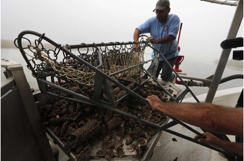
In this March 11, 2019, photo, Robert Campo, an oyster fisherman and marina owner, pulls in material from what used to be a thriving oyster bed in Yscloskey, La. Campo and others worry that diverted Mississippi River water will flood their fishing areas and destroy an industry vital to the state's economy and culture. (AP Photo/Gerald Herbert)
Haase, from CPRA, said operators will have much more control over the diversion systems than they have over the spillway. A system of monitors will alert them to how the ecosystem is responding so they can make changes.
He said the federal permitting process will help identify areas, such as oyster grounds, that might be affected by the diversions, so the state can help them.
"If we're going to get to where we think we need to get on our coast, bold action is required," Haase said. "These are bold projects."
© 2019 The Associated Press. All rights reserved.
