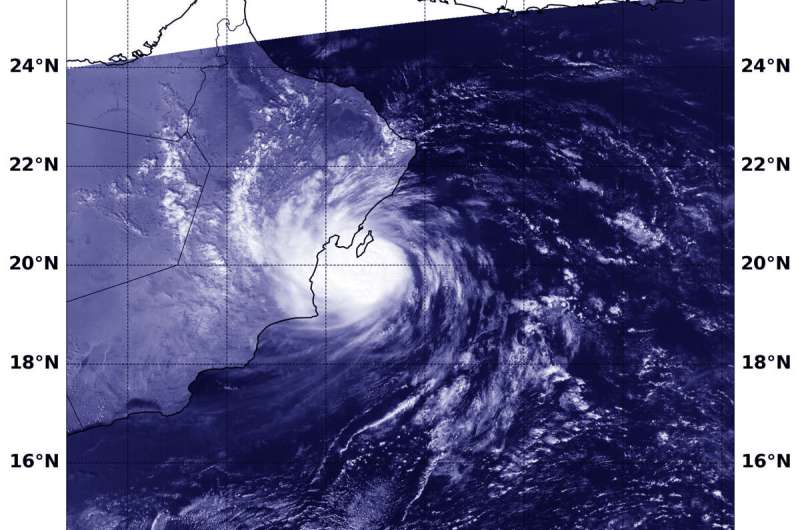
On Sept. 24 at 5:30 a.m. EDT (0930 UTC), NASA-NOAA's Suomi NPP satellite captured a visible image of Tropical Storm Hikaa along the coast of Oman in the Northern Indian Ocean. Credit: NASA/NOAA/NRL
NASA-NOAA's Suomi NPP satellite passed over the Arabian Sea in the Northern Indian Ocean and provided forecasters with a view of Cyclone Hikaa's structure. Hikaa is at hurricane strength along Oman's coast.
On Sept. 24 at 5:30 a.m. EDT (0930 UTC), the Visible Infrared Imaging Radiometer Suite (VIIRS) instrument aboard Suomi NPP provided a visible image of Cyclone Hikaa. The VIIRS image showed that the storm was close to the eastern coast of Oman and its center was just south of Masirah Island. Hikaa's western quadrant was over the coast bringing gusty winds and heavy rainfall.
At 11 a.m. EDT (1500 UTC) on Sept. 24, the center of Cyclone Hikaa was located near latitude 19.9 degrees north and longitude 58.4 degrees east. That puts Hikaa's center just 38 nautical miles southwest of Masirah Island. Hikaa was moving to the west and maximum sustained winds have increased to near 75 knots (86 mph/139 kph) with higher gusts.
Hikaa is approaching landfall in Oman near Duqm. The storm will dissipate inland.
Hurricanes are the most powerful weather event on Earth. NASA's expertise in space and scientific exploration contributes to essential services provided to the American people by other federal agencies, such as hurricane weather forecasting.
Provided by NASA's Goddard Space Flight Center


