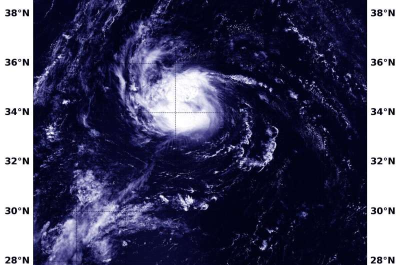
On Sept. 8, 2019 at 2:35 p.m. EDT (1635 UTC) the MODIS instrument aboard NASA's Aqua satellite provided a visible image of Gabrielle moving through the Central Atlantic Ocean. Credit: NASA/NRL
NASA's Aqua satellite passed over the Central Atlantic Ocean and provided a visible view of Tropical Storm Gabrielle that helped pinpoint its strongest side.
On Sept. 8, 2019 at 2:35 p.m. EDT (1635 UTC), the Moderate Resolution Imaging Spectroradiometer or MODIS instrument aboard NASA's Aqua satellite provided a visible image of Gabrielle that showed strongest thunderstorms northeast of the center.
The MODIS image also showed that there were also fragmented bands of strong thunderstorms south and southwest of the center.
On Sept. 9, NOAA's National Hurricane Center or NHC said, "Deep convection associated with Gabrielle has become somewhat less organized overnight with the center located near the northeastern portion of the coldest cloud tops."
NASA satellites provide research data on structure, rainfall, winds and temperature of tropical cyclones. Those data are shared with forecasters at NHC to incorporate in their forecasts.
NHC noted at 5 a.m. EDT (0900 UTC), on Sept. 9 that the center of Tropical Storm Gabrielle was located near latitude 37.7 degrees north and longitude 48.5 degrees west. Gabrielle's center is about 1,170 miles (1.885 km) west of the Azores Islands.
Gabrielle is moving toward the north-northeast near 16 mph (26 kph). A turn toward the northeast with an increase in forward speed is expected today, Sept. 9 and a northeastward motion at an even faster forward speed is expected on Tuesday and Wednesday. Maximum sustained winds are near 60 mph (95 kph) with higher gusts. The estimated minimum central pressure is 997 millibars.
NHC said, "Little change in strength is expected today, but a weakening trend is likely to begin tonight." Weakening is expected because Gabrielle will be moving into an area of outside winds (vertical wind shear) and cooler sea surface temperatures.
Gabrielle is expected to become an extratropical low pressure area by Tuesday night, Sept. 10 and the extratropical low is predicted to slowly weaken and be absorbed by a larger low pressure system over the northeastern Atlantic in a little more than 3 days
More information: For updated forecasts, visit: http://www.nhc.noaa.gov
Provided by NASA's Goddard Space Flight Center


