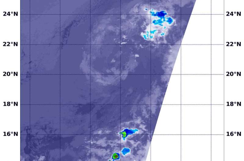
On July 8 at 6:15 a.m. EDT (1015 UTC), NASA's Aqua satellite passed over the Cosme from space. The storm appeared to have a circulation of wispy high clouds. Credit: NASA/NRL
Tropical Storm Cosme formed in the Eastern Pacific Ocean over the weekend of July 6 and 7 and after two days, the storm already weakened to a remnant low pressure area. NASA's Aqua satellite found the storm devoid of strong thunderstorms and appeared as a wispy ring of clouds.
Tropical Storm Cosme formed in the Eastern Pacific Ocean over the weekend of July 6 and 7 and after two days, the storm already weakened to a remnant low pressure area. NASA's Aqua satellite found the storm devoid of strong thunderstorms and appeared as a wispy ring of clouds.
At 11 a.m. EDT (1500 UTC) on Saturday, July 6, Tropical Storm Cosme formed near latitude 15.6 degrees north and longitude 115.7 degrees west. That is about 630 miles (1,015 km) southwest of the southern tip of Baja California, Mexico.
On July 8 at 6:15 a.m. EDT (1015 UTC), NASA's Aqua satellite passed over the Cosme from space. The storm appeared to have a circulation of wispy high clouds. Five hours later, the low pressure area was devoid of precipitation and the National Hurricane Center noted, "Cosme has degenerated into a large swirl of mostly cold-air stratocumulus clouds."
At 11 a.m. EDT (1500 UTC), the center of Post-Tropical Cyclone Cosme was located near latitude 20.5 North, longitude 120.7 West. Cosme reached its peak later on the day it formed when maximum sustained winds topped out at 50 mph (85 kph) around 5 p.m. EDT. Since then, Cosme was on a weakening trend.
The update on July 8 at 11 a.m. EDT (1500 UTC) was the last public advisory issued by the National Hurricane Center on Cosme. Cosme degenerated into a post-tropical remnant low pressure area. At that time, Cosme was located about 710 miles (1,140 km) west of the southern tip of Baja California, Mexico. The National Hurricane Center noted that the post-tropical cyclone is moving toward the northwest near 8 mph (13 kph) and this general motion is expected to continue for the next couple of days with a decrease in forward speed. Maximum sustained winds are near 30 mph (45 kph) with higher gusts.
Weakening is expected during the next 48 hours, and the remnant low pressure area is forecast to dissipate by Wednesday, July 10.
Provided by NASA's Goddard Space Flight Center


