NASA finds winds tore Tropical Storm 04W apart

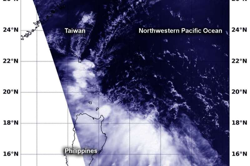
Visible imagery from NASA's Aqua satellite showed Tropical Cyclone 04W had been torn apart from wind shear in the Northwestern Pacific Ocean.
On Saturday, June 29, Tropical Storm 04W developed east of the Philippines and was moving toward the northwest. 04W formed near 15.3 north latitude and 130.7 east longitude, about 564 miles east of Manila, Philippines. At that time, 04W had maximum sustained winds near 35 knots (40 mph)
The next day, the Joint Typhoon Warning Center issued their final bulletin on 04W. This short-lived storm weakened to a depression just over 24 hours from its development. Although it moved close enough to the Philippines to get the local name of Egay, and to trigger a tropical cyclone warning signal #1 for the Batanes province in Luzon, 04W weakened to a depression by 11 a.m. EDT (1500 UTC) on June 30.
At the time of the final warning, 04W was located near 18.4 north latitude and 126.6 east longitude, about 395 nautical miles northeast of Manila, Philippines.
Northeasterly vertical wind shear was tearing the storm apart. In general, wind shear is a measure of how the speed and direction of winds change with altitude. Tropical cyclones are like rotating cylinders of winds. Each level needs to be stacked on top each other vertically in order for the storm to maintain strength or intensify. Wind shear occurs when winds at different levels of the atmosphere push against the rotating cylinder of winds, weakening the rotation by pushing it apart at different levels.
On July 1 at 12:40 a.m. EDT (4:40 p.m. EDT), the Moderate Resolution Imaging Spectroradiometer or MODIS instrument aboard NASA's Aqua satellite provided a visible image of 04W's remnants. Clouds associated with the former tropical storm appeared fragmented between Luzon, the northern Philippines, and Taiwan. Satellite imagery showed the low level circulation had unraveled into a broad, weak circulation.
The remnants are expected to continue moving northwest and dissipate.
Provided by NASA's Goddard Space Flight Center


