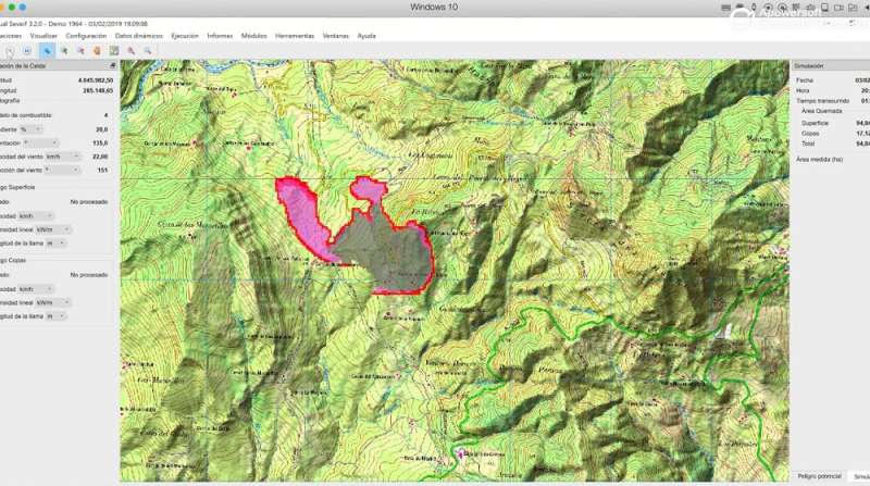
Visualization of a fire spread on VisualSEVEIF. Credit: Universidad de Córdoba
High temperatures and low humidity—summer is approaching and with it the fire season. The lack of precipitation also makes 2019 a year characterised by risk, so some Spanish regions, such as the Balearic Islands, have taken swift action and already begun their prevention operations. According to a report from the Ministry of Agriculture, Fisheries and Food, every year there are an average of 12,000 fires and outbreaks, affecting more than 100,000 hectares of forest. This means not only enormous damage to the environment, but also to the economy.
Assessments of the impacts of forest fires tend to underestimate their economic repercussions, since they only take into account the loss of tangible resources; those that can be bought and sold, such as wood, grass, fruit and even animals that are hunted. However, thanks to research on environmental economics, they are also beginning to measure the intangible resources of forests; that is, those that are not involved in the traditional market of sales and purchases.
Until recently, the value of forests for human leisure and recreation, for their beauty as landscapes, and for their carbon fixation (the ability of a forest to transform CO2 into organic matter) were not taken into account when gauging the economic impact of a forest fire.
A research group at the University of Cordoba is working on a visual tool to determine the behaviour of a fire in an area, and to measure the economic losses it causes in a more precise way, evaluating not only the tangible resources, but also the intangible ones. This tool is the Visual Seveif programme, used for the measurement of the economic impact of forest fires, which has been under development for the past several years. Each of the variables and equations that are incorporated into the tool to assess economic impact are supported by scientific research. The last variable is carbon fixation.
To generate this equation which measures economic losses in relation to the carbon fixation of a forest, two different fires were analysed, as published by the research group comprised of University of Cordoba professors Francisco Rodríguez Silva, Miguel Ángel Herrera, and Juan Ramón Molina, in the journal Environmental Impact Assessment Review. The first of these fires took place in 2011, in Cerro Vértice, in the province of Córdoba, devastating more than 140 hectares of scrubland, pine forests and pastures. The second one was started by the crash of a military aircraft in Cañadas Catena, in Jaén, where more than 200 hectares of dense pine forest burned.
Multiple variables were taken into account, such as the value of carbon, the carbon fixation capacity of each of the species, the age of the trees, and even the years of exploitation stipulated in the forest management plan. But these economic losses of a fire have until now never been fully accounted for—they also depend on the duration of the fire and its intensity. In the Visual Seveif program, all this is accounted for, with the objective of estimating economic impact as accurately as possible.
This tool is already being used in various fields of scientific research and also in direct fire management. The next step is to convert this software into a Web platform to facilitate user access and make calculations quickly, to help identify and prioritise areas for restoration activities and optimise the allocation of resources.
More information: J.R. Molina et al, Wildfire-induced reduction in the carbon storage of Mediterranean ecosystems: An application to brush and forest fires impacts assessment, Environmental Impact Assessment Review (2019). DOI: 10.1016/j.eiar.2019.02.008
Provided by University of Córdoba


