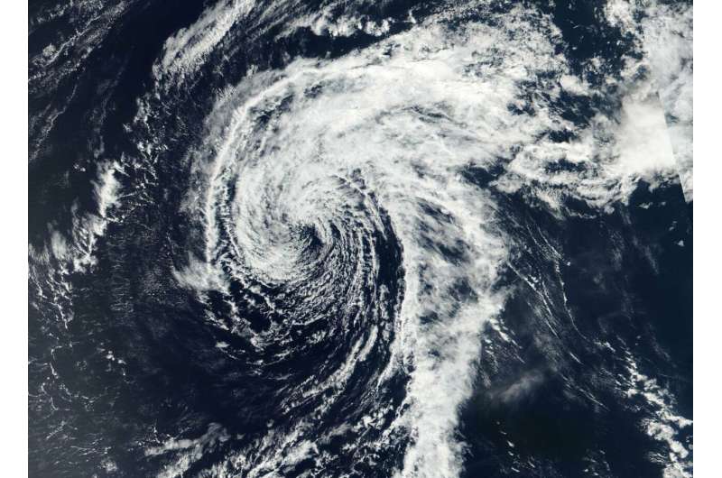
Wutip now a depression, spotted on NASA-NOAA satellite imagery

Once a super typhoon, Tropical Cyclone Wutip weakened to a depression on February 28. NASA-NOAA's Suomi NPP satellite passed over the Northwestern Pacific Ocean and captured an image the wispy looking-storm being battered by vertical wind shear.
In general, wind shear is a measure of how the speed and direction of winds change with altitude. Wind shear can tear a tropical cyclone apart or weaken it.
Wind shear and cooler waters knocked the wind out of Wutip and weakened the storm rapidly. On Feb 28, the Visible Infrared Imaging Radiometer Suite (VIIRS) instrument aboard the Suomi NPP satellite showed that Wutip still had a defined center, although elongated from the outside winds. Bands of clouds wrapping around the center appeared to be wispy and devoid of heavy rain.
At 10 a.m. EDT (1500 UTC) on Feb. 28 (1 a.m. CHST local time, March 1) the National Weather Service in Tiyan, Guam noted that the center of Tropical Depression Wutip was located near Latitude 18.3 degrees North and Longitude 134.6 degrees East. That's about 755 miles west-northwest of Guam and about 765 miles west-northwest of Saipan.
Wutip was moving northwest at 10 mph. It is expected to make a turn toward the west with a decrease in forward speed over the next 24 hours. Maximum sustained winds have decreased to 30 mph and is forecast to dissipate sometime on Saturday, March 1, EDT.
Provided by NASA's Goddard Space Flight Center


