Threatening Typhoon Yutu probed by GPM Satellite

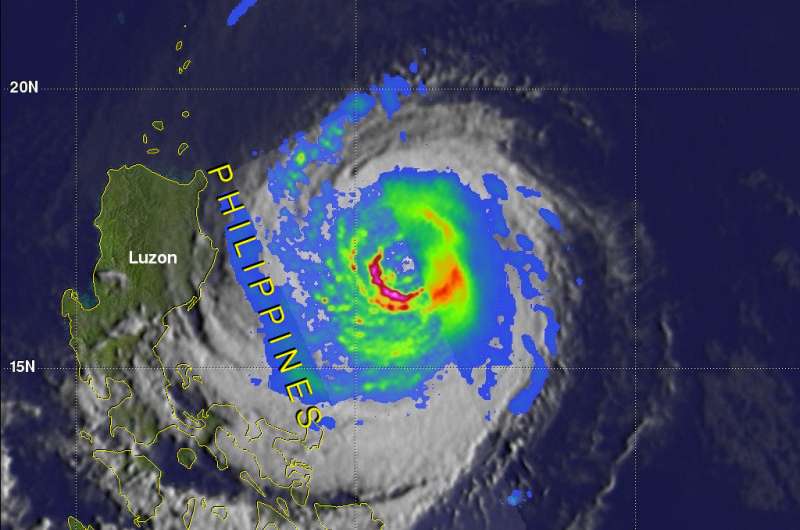
Typhoon Yutu, known as Rosita in the Philippines, is now threatening the Philippine Island of Luzon. The Global Precipitation Measurement mission or GPM core satellite provided a look at the heavy rainfall the storm is packing.
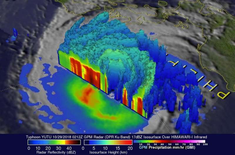
On Oct. 24, 2018 Yutu devastated the Northern Mariana Islands of Tinian and Saipan as a super typhoon. One death has been attributed to the typhoon in the Mariana with many structures including schools and hospitals being destroyed. Typhoon Yutu weakened as it moved toward the Philippines and had maximum sustained winds of about 90 knots (103.5 mph) when the GPM core observatory satellite passed above the Philippine Sea on Oct. 29, 2018 at 0212 UTC (Oct. 28 at 10:12 p.m. EDT).
By 11 a.m. EDT (1500 UTC) on Oct. 29, Yutu's maximum sustained winds remained at the same strength as they were earlier. Yutu was located near 16.7 degrees north latitude and 123.6 east longitude. That's about 224 nautical miles northeast of Manila, Philippines.
At NASA's Goddard Space Flight Center in Greenbelt, Maryland, a rainfall analysis was developed using data collected by GPM's Microwave Imager (GMI) and Dual-Frequency Precipitation Radar (DPR) instruments. Those GPM data revealed that heavy rainfall within the typhoon covered an area the size of Luzon. Extreme precipitation falling at a rate of over 178 mm (7 inches) per hour was also revealed by GPM's radar (DPR Ku Band) within powerful storms in Yutu's southwestern eye wall.
The GPM mission is managed by both NASA and the Japan Aerospace Exploration Agency, JAXA.
The Joint Typhoon Warning Center (JTWC) predicts that typhoon Yutu will still be a powerful typhoon with winds of about 85 knots (98 mph) when it makes landfall in the Philippines. Interaction with the rugged terrain over Luzon is expected to cause Yutu to weaken to tropical storm intensity. Yutu is then expected to intensify to typhoon again as it moves into the South China Sea. Typhoon Yutu is then expected to re-curve to the east of Hong Kong.

Provided by NASA's Goddard Space Flight Center


