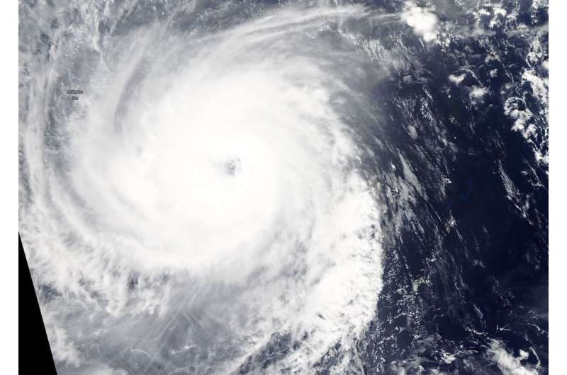
On Oct. 25, 2018 at 1:30 p.m. CHST (local time, Guam) the MODIS instrument aboard Aqua captured a visible image of Typhoon Yutu with a 19 nautical mile oblong eye. Credit: NASA Worldview, Earth Observing System Data and Information System (EOSDIS).
Visible satellite imagery from NASA's Aqua satellite captured powerful Super Typhoon Yutu as it moved through the Philippine Sea. Yutu's eye appeared oblong on satellite imagery.
On Oct. 25 at 1:30 p.m. CHST (local time, Guam) the Moderate Resolution Imaging Spectroradiometer or MODIS instrument aboard Aqua captured a visible image of Yutu. The MODIS image showed that large typhoon Yutu continued to remain symmetric with an open 19 nautical-mile-wide eye surrounded by very thick bands of powerful thunderstorms circling the center. At the time of the image, Yutu had passed and cleared Guam.
In satellite imagery on Oct. 26, the eye had become cloud-filled. Infrared satellite imagery revealed cooler cloud tops (indicating the uplift of air had strengthened) and a contracting eye occurring after the storm experienced an eyewall replacement cycle.
Mature, intense tropical cyclones can and often undergo an eyewall replacement cycle. That's where a new eyewall or ring of thunderstorms within the outer rain bands forms further out from the storm's center, outside of the original eye wall. That ring of thunderstorms then begins to choke off the original eye wall, starving it of moisture and momentum. Eventually, if the cycle is completed, the original eye wall of thunderstorms dissipates and the new outer eye wall of thunderstorms contracts and replace the old eye wall. The storm's intensity can fluctuate over this period, initially weakening as the inner eye wall dies before again strengthening as the outer eye wall contracts.
The National Weather Service (NWS) in Tiyan, Guam continued to issue a small craft advisory on Oct. 26. The NWS noted for Marianas Waters "Winds and seas will remain elevated, then slowly subside over the weekend as Super Typhoon Yutu moves away from the Marianas. A Small Craft Advisory remains in effect through Saturday afternoon."
At 11 a.m. EDT (1500 UTC) on Oct. 26, the Joint Typhoon Warning Center or JTWC noted that Yutu had maximum sustained winds near 135 knots (155.4 mph/250 kph).
Super Typhoon Yutu was the equivalent of a Category 4 hurricane on the Saffir-Simpson Hurricane Wind Scale. Yutu was centered near 17.3 degrees north latitude and 136.9 east longitude. It was about 465 nautical miles west-northwest of Navsta, Guam. Yutu was moving toward the west-northwest.
The JTWC forecast carries Yutu west toward the northern Philippines through Oct. 31. Yutu is expected to maintain typhoon strength through that time.
Provided by NASA's Goddard Space Flight Center


