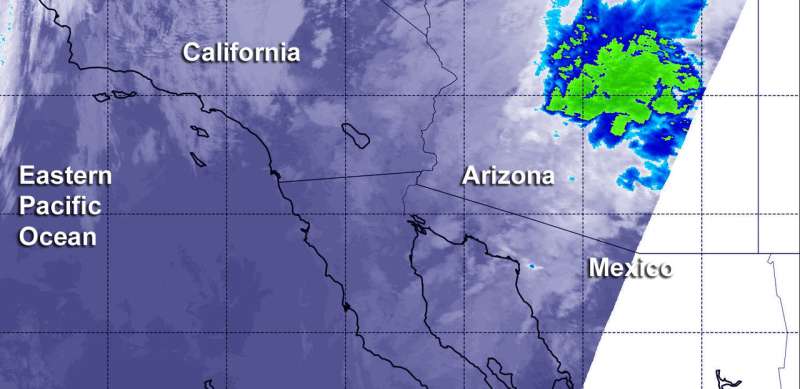
NASA's Aqua satellite shows Rosa's remnants soaking Arizona

NASA provided an infrared view of Tropical Depression Rosa's remnants that showed strongest storms with heaviest rainfall potential were over east central Arizona on Oct. 2. The National Hurricane Center noted that although Rosa had dissipated by 11 a.m. EDT on Oct. 2, the threat of heavy rains and flash flooding continues over the Desert Southwest.
NOAA's National Weather Service Weather Prediction Center in College Park, Md. noted "Heavy tropical rain from Rosa will bring flash flood threats to the Desert Southwest and Four Corners region over the next couple of days. Flood Watches are in effect for multiple states, including California, Arizona, Nevada, Utah, Colorado and Idaho. There is also a moderate risk of excessive rain for central portions of Arizona."
Infrared satellite data captured on Tuesday, Oct. 2 at 6:05 a.m. EDT (1005 UTC the Moderate Resolution Imaging Spectroradiometer or MODIS instrument aboard NASA's Aqua satellite revealed the location of strongest storms with the coldest cloud top temperatures. MODIS found coldest cloud tops had temperatures near minus 63 degrees Fahrenheit (minus 53 degrees Celsius). NASA research has found that cloud top temperatures that cold have the capability to generate heavy rainfall.
Satellite images and surface observations indicate that Rosa has become a trough or an elongated area of low pressure with multiple swirls along its axis. Therefore, Rosa no longer qualifies as a tropical cyclone.
That heavy rainfall potential that NASA's infrared data showed are reflected in the forecast today, Oct. 2 and tomorrow, Oct. 3. In Baja California and northwestern Sonora, 3 to 6 inches are forecast with isolated 10 inches. In central and southern Arizona 2 to 4 inches are forecast with isolated 6 inch totals are possible in the mountains of central Arizona. For the rest of the Desert Southwest, Central Rockies, and Great Basin, the National Hurricane Center forecast expects between 1 to 2 inches, with isolated totals to 4 inches. These rainfall amounts may produce life-threatening flash flooding. Dangerous debris flows and landslides are also possible in mountainous terrain.
At 11 a.m. EDT (1500 UTC), the remnants of Rosa were located near latitude 29.7 degrees north and longitude 114.2 degrees west. That's about 95 miles (155 km) south-southeast of San Felipe, Mexico. The remnants are moving toward the northeast near 8 mph (13 kph), and they are expected to move over the Desert Southwest by tonight. Maximum sustained winds are near 30 mph (45 kph) with higher gusts.
Provided by NASA's Goddard Space Flight Center


